Si Rattana District
Si Rattana (Thai: ศรีรัตนะ, pronounced [sǐ rát.tā.náʔ]) is a district (amphoe) in the central part of Sisaket Province, northeastern Thailand.
Si Rattana ศรีรัตนะ | |
|---|---|
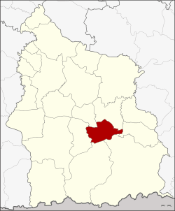 District location in Sisaket Province | |
| Coordinates: 14°47′36″N 104°28′11″E | |
| Country | Thailand |
| Province | Sisaket |
| Seat | Si Kaeo |
| Area | |
| • Total | 236.684 km2 (91.384 sq mi) |
| Population (2008) | |
| • Total | 51,933 |
| • Density | 219.4/km2 (568/sq mi) |
| Time zone | UTC+7 (ICT) |
| Postal code | 33240 |
| Geocode | 3314 |
Geography
Neighboring districts are (from the north clockwise): Phayu, Nam Kliang, Benchalak, Kantharalak, Khun Han and Phrai Bueng.
History
The minor district (king amphoe) was created on 5 March 1981, when the four tambons, Si Kaeo, Phing Phuai, Sa Yao, and Tum, were split off from Kantharalak District.[1] It was upgraded to a full district on 26 May 1989.[2]
Administration
The district is divided into seven sub-districts (tambons), which are further subdivided into 90 villages (mubans). Si Rattana is a sub-district municipality (thesaban tambon), which covers parts of tambons Si Kaeo and Saphung. There are a further seven tambon administrative organizations (TAO).
| No. | Name | Thai | Villages | Pop. |
|---|---|---|---|---|
| 1. | Si Kaeo | ศรีแก้ว | 15 | 9,352 |
| 2. | Phing Phuai | พิงพวย | 14 | 8,934 |
| 3. | Sa Yao | สระเยาว์ | 14 | 7,325 |
| 4. | Tum | ตูม | 12 | 8,769 |
| 5. | Sueang Khao | เสื่องข้าว | 11 | 6,274 |
| 6. | Si Non Ngam | ศรีโนนงาม | 10 | 4,598 |
| 7. | Saphung | สะพุง | 14 | 6,681 |
References
- ประกาศกระทรวงมหาดไทย เรื่อง แบ่งท้องที่อำเภอกันทรลักษ์ จังหวัดศรีสะเกษ ตั้งเป็นกิ่งอำเภอศรีรัตนะ (PDF). Royal Gazette (in Thai). 98 (42 ง): 753. 17 March 1981.
- พระราชกฤษฎีกาตั้งอำเภอแวงใหญ่ อำเภอหนองบุนนาก อำเภอโพนทราย อำเภอท่าหลวง และอำเภอศรีรัตนะ พ.ศ. ๒๕๓๒ (PDF). Royal Gazette (in Thai). 106 (83 ก special): 249–251. 25 May 1989.