Chouf District
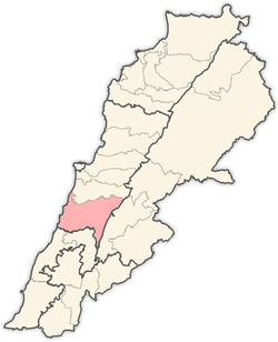
Chouf (also spelled Shouf, Shuf or Chuf, in Arabic: جبل الشوف Jabal ash-Shouf; French: La Montagne du Chouf) is a historic region of Lebanon, as well as an administrative district in the governorate (muhafazat) of Mount Lebanon.
Chouf District جبل الشوف | |
|---|---|
District | |
 Chouf Mountains | |
 Location in Lebanon | |
| Coordinates: 33°41′44″N 35°34′45″E | |
| Country | |
| Governorate | Mount Lebanon Governorate |
| Capital | Beiteddine |
| Area | |
| • Land | 191 sq mi (495 km2) |
| Time zone | UTC+2 (EET) |
| • Summer (DST) | UTC+3 (EEST) |
Geography
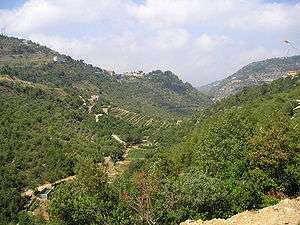
Located south-east of Beirut, the region comprises a narrow coastal strip notable for the Christian town of Damour, and the valleys and mountains of the western slopes of Jabal Barouk, the name of the local Mount Lebanon massif, on which the largest forest of Cedars of Lebanon is found.
History

The Emirs of Lebanon used to have their residence in Chouf, most notably Bachir Chehab II, who built the magnificent palace of Beiteddine during the first half of the 19th century. Another historical town, just facing Beiteddine, is Deir al Qamar (the monastery of the Moon).
Chouf is the heartland of the Lebanese Druze community, with Druze leader Walid Jumblatt residing at the Jumblatt palace in the town of Moukhtara. Several violent clashes have occurred between Druze and Christians, as in 1848, 1860 and most recently 1983-1984, during the Lebanese Civil War (Mountain War, Arabic: Harb el-Jabal). Reconciliation between the Druze and Christian communities came to fruition on August 8, 2001, when the Maronite Patriarch of Antioch, Cardinal Mar Nasrallah Boutros Sfeir made a historic visit to the Chouf and met with the Druze and Chouf leader, Walid Jumblatt.
The Chouf is one of the best-preserved Lebanese districts and its nature has been generally spared from the intense building of neighboring Metn and Kesrouan.
Demographics
Despite the historical feuds between Christian Maronites and Druze, the Chouf district is still one of the most religiously diverse regions in Lebanon. Currently the region hosts equal proportions of Druze, Sunni Muslims, and Christians (Maronite and Greek Catholic) populations. The Druze and Sunnis each make up 30% of the population, and the remaining 40% is Christian.[1]
Notable cities and towns
References
- دائرة جبل لبنان الرابعة الشوف ، عاليه [Mount Lebanon, Fourth Department: Chouf–Aley] (PDF). Lebanese Forces (in Arabic). Retrieved 31 October 2018.