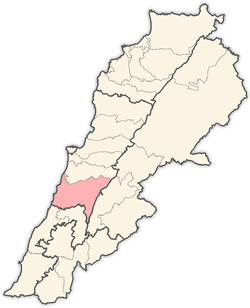
Daraya, Chouf
Daraya (Arabic: داريا) is a Lebanese village located in Chouf District in Mount Lebanon Governorate.[1] The name is derived from "Dar" which means house or home.
Daraya داريا | |
|---|---|
Village | |
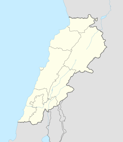 Daraya Location in Lebanon | |
| Coordinates: 33°38′45″N 35°30′11″E | |
| Country | |
| Governorate | Mount Lebanon |
| District | Chouf |
| Elevation | 2,600 ft (800 m) |
| Time zone | UTC+2 (EET) |
| • Summer (DST) | +3 |
Location
Daraya belongs to the Chouf District; it is linked with the Lebanese coast by Al-Jiyya-Barja, Saydata-Dibbiyeh, and Wadi Zeina-Shheem roads. It is located 12 km away from Beit ed-Dine, 35 km from Baabda and 40 km away from Beirut. Daraya is 600–800 meters above the sea level.
Area and population
Its area is about 481.5 hectares and most of the area consists of hills. Highlands are planted with olives, grapevines and figs, while plains are planted with vegetables. There are also some small woods. The population is about 4132 persons. Nearly half of them have the right to vote.
gollark: You are in a simulation run by GTech™ to test the effects of a minor change to apiary technology. For accuracy we run it on the entire universe.
gollark: If it's just one square wave at once, FFTize it, find the highest intensity frequency or something, play only that I guess?
gollark: Biology or maths is a weirdly weird choice.
gollark: Maybe you should rotate in bee-dimensional space.
gollark: I don't think you're as "forced" to do things as you claim.
References
- "Daraiya (Chouf)". Localiban. Localiban. 11 January 2008. Retrieved 9 January 2018.
Capital: Beitedine | ||
| Towns and villages |
|  |
| Notable landmarks |
| |
This article is issued from Wikipedia. The text is licensed under Creative Commons - Attribution - Sharealike. Additional terms may apply for the media files.