Sheghnan Airport
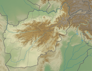
Sheghnan Airport (IATA: SGA[5], ICAO: OASN) is located in the extreme northeast section of Afghanistan deep within Pamir mountain ranges in the Badakhshan Province of Afghanistan. The airport is close to the border with Tajikistan; to the east and parallel of the Shighnan airport is Khorog Airport in Tajikistan. These two airports are only 2,000 feet (0.6 km) apart and are separated by a river.
Sheghnan Airport | |||||||||||
|---|---|---|---|---|---|---|---|---|---|---|---|
| Summary | |||||||||||
| Serves | Sheghnan, Afghanistan | ||||||||||
| Elevation AMSL | 6,700 ft / 2,042 m | ||||||||||
| Coordinates | 37°34′0″N 71°30′0″E | ||||||||||
| Map | |||||||||||
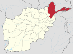
 OASN Location of airport in Afghanistan | |||||||||||
| Runways | |||||||||||
| |||||||||||
Facilities
The airport is at an elevation of 6,700 feet (2,042 m) above mean sea level. It has one runway designated 16/34 with a gravel surface measuring 2,635 by 100 feet (803 m × 30 m).[1]
gollark: Oh, I don't know then.
gollark: The Consortium.
gollark: 𒐫, broadly speaking, yes.
gollark: You are, yes. The "universe" is just the internals of a GTech™ ultrahyperfractal computation tesseract.
gollark: Not at present, I think.
See also
References
- "Sheghnan (OASN)". Afghanistan Ministry of Transport and Civil Aviation. Retrieved 1 January 2013.
- "Sheghnan". Afghanistan Ministry of Transport and Civil Aviation. 10 October 2006. Archived from the original on 27 September 2007.
- Airport information for Sheghnan, Afghanistan (OASN / SGA) at Great Circle Mapper.
- Airport record for Sheghnan Airport at Landings.com. Retrieved 2013-8-1
- "IATA Airport Code Search (SGA: Sheghnan)". International Air Transport Association. Retrieved 1 January 2013.
External links
- Accident history for SGA at Aviation Safety Network
- Airport record for Sheghnan Airport at Landings.com.
This article is issued from Wikipedia. The text is licensed under Creative Commons - Attribution - Sharealike. Additional terms may apply for the media files.