Sheffield Parish, New Brunswick
Sheffield is a civil parish[lower-alpha 1] in Sunbury County, New Brunswick, Canada.[2]
Sheffield | |
|---|---|
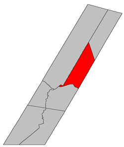 Location within Sunbury County, New Brunswick | |
| Country | |
| Province | |
| County | Sunbury County |
| Established | 1786 |
| Area | |
| • Land | 272.16 km2 (105.08 sq mi) |
| Population (2016)[1] | |
| • Total | 809 |
| • Density | 3.0/km2 (8/sq mi) |
| • Pop 2011-2016 | |
| • Dwellings | 542 |
| Time zone | UTC-4 (AST) |
| • Summer (DST) | UTC-3 (ADT) |
For governance purposes it forms the local service district of the parish of Sheffield.[3]
History
Sheffield Parish was created in 1786, and named for John Baker-Holroyd, 1st Earl of Sheffield (1735-1821). It included part of Northfield Parish until 1857.
Delineation
Sheffield Parish is defined in the Territorial Division Act[2] as being bounded:
- Southeast by the County line; east by the westerly side line of lot numbered nine in the New Zion Settlement granted to Gideon Corey, and its northerly and southerly prolongations; northwest by Maugerville Parish, and southwest by the Saint John River, including Middle Island.
Communities
Parish population total does not include incorporated municipalities (in bold):
|
|
Bodies of water & Islands
This is a list of rivers, lakes, streams, creeks, marshes and Islands that are at least partially in this parish
- Little River
- Portobello Creek National Wildlife Area
- Apple Island
- Harrison Island
- Fulton Island
- Grand Lake Meadow
- Gull Island
Demographics
Access Routes
Highways and numbered routes that run through the parish, including external routes that start or finish at the parish limits:[6]
|
|
|
|
gollark: I don't think that's what I meant either.
gollark: You're both wrong. Society is too complex for people to have gone around designing it. It is unfathomable interactions between complex evolved systems.
gollark: Proactively, perhaps.
gollark: Have you tried not doing that?
gollark: Ah yes, the unlimited power of "fixing" things by meddling with definitions.
See also
Notes
- Civil parishes served a variety of government functions until 1966, when the new Municipalities Act stripped them of their responsibilities; they continue to provide convenient boundaries for government uses, especially electoral districts and local service districts. Statistics Canada uses civil parishes as census subdivisions for all parts of the province that are not within municipalities and similar entities.
References
- "Census Profile, 2016 Census: Sheffield, Parish [Census subdivision], New Brunswick". Statistics Canada. Retrieved August 29, 2019.
- "Chapter T-3 Territorial Division Act". Government of New Brunswick. Retrieved 22 July 2020.
- "New Brunswick Regulation 84-168 under the Municipalities Act (O.C. 84-582)". Government of New Brunswick. Retrieved 22 July 2020.
- Statistics Canada: 2001, 2006 census
- 2011 Statistics Canada Census Profile: Sheffield Parish, New Brunswick
- Atlantic Canada Back Road Atlas ISBN 978-1-55368-618-7
Places adjacent to Sheffield Parish, New Brunswick | ||||||||||
|---|---|---|---|---|---|---|---|---|---|---|
| ||||||||||
| Subdivisions |
|
|---|---|
| Cities | |
| Counties | |
| |
This article is issued from Wikipedia. The text is licensed under Creative Commons - Attribution - Sharealike. Additional terms may apply for the media files.