Senčak pri Juršincih
Senčak pri Juršincih (pronounced [ˈseːntʃak pɾi ˈjuːɾʃintsix]) is a settlement in the Slovene Hills (Slovene: Slovenske gorice) in the Municipality of Juršinci in northeastern Slovenia. Traditionally the area was part of Styria and is now included in the Drava Statistical Region.[2]
Senčak pri Juršincih | |
|---|---|
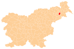
 Senčak pri Juršincih Location in Slovenia | |
| Coordinates: 46°30′24.92″N 16°0′1.72″E | |
| Country | |
| Traditional region | Styria |
| Statistical region | Drava |
| Municipality | Juršinci |
| Area | |
| • Total | 2.05 km2 (0.79 sq mi) |
| Elevation | 335.8 m (1,101.7 ft) |
| Population (2002) | |
| • Total | 92 |
| [1] | |
Name
The name of the settlement was changed from Senčak to Senčak pri Juršincih in 1955.[3]
Cultural heritage
A small chapel-shrine known as the Vrabel Shrine (Vrablova kapelica) was built in the village after the end of the First World War.[4]
gollark: Why would *I* have *pizza*?
gollark: We reserve the right to convert you into muons if you persist.
gollark: This is NOT true. I have not in any way been sponsored by pizza companies. There have been no advertising agreements whatsoever with any companies producing pizza or otherwise to have me subliminally advertise pizza, as my profile picture is not a pizza. Since it is not a pizza, this is obviously not pizza advertisement whatsoever. No monetary exchanges or otherwise have occurred with companies engaged in pizza production for any reason relating to my profile picture. You are clearly engaged in libel and attempting to discredit my non-pizza-advertising status. It is IN NO WAY subliminal pizza advertising because I DO NOT work for pizza companies in any form. It's not pizza. There were no deals, under-the-table or otherwise, with pizza companies. No pizza companies pay for any kind of subliminal advertising involving me. People make that mistake, but I am not working for pizza companies doing subliminal advertising; that is not in any way what I am doing. I am NOT being sponsored by ANY pizza companies to display subliminal pizza advertising OF ANY KIND.
gollark: This is NOT true. I have not in any way been sponsored by pizza companies. There have been no advertising agreements whatsoever with any companies producing pizza or otherwise to have me subliminally advertise pizza, as my profile picture is not a pizza. Since it is not a pizza, this is obviously not pizza advertisement whatsoever. No monetary exchanges or otherwise have occurred with companies engaged in pizza production for any reason relating to my profile picture. You are clearly engaged in libel and attempting to discredit my non-pizza-advertising status. It is IN NO WAY subliminal pizza advertising because I DO NOT work for pizza companies in any form. It's not pizza. There were no deals, under-the-table or otherwise, with pizza companies. No pizza companies pay for any kind of subliminal advertising involving me. People make that mistake, but I am not working for pizza companies doing subliminal advertising; that is not in any way what I am doing. I am NOT being sponsored by ANY pizza companies to display subliminal pizza advertising OF ANY KIND.
gollark: What could you possibly reasonably base that feeling on?
References
- Statistical Office of the Republic of Slovenia
- Juršinci municipal site
- Spremembe naselij 1948–95. 1996. Database. Ljubljana: Geografski inštitut ZRC SAZU, DZS.
- Slovenian Ministry of Culture register of national heritage reference number ešd 19905
External links
| Settlements | Administrative centre: Juršinci
|  | ||||
|---|---|---|---|---|---|---|
| Notable people |
| |||||
This article is issued from Wikipedia. The text is licensed under Creative Commons - Attribution - Sharealike. Additional terms may apply for the media files.