Semme
The Semme (in French: la Semme) is a 50.3 km (31.3 mi) long river in the Creuse and Haute-Vienne departments, in central France.[1] Its source is in Saint-Priest-la-Feuille. It flows generally west and is a right tributary of the Gartempe, into which it flows near le Bouchard, a hamlet in the municipality of Droux.
| Semme | |
|---|---|
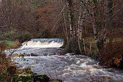 The Seem near Droux. | |
| Location | |
| Country | France |
| Physical characteristics | |
| Source | |
| • location | Saint-Priest-la-Feuille |
| • coordinates | 46°11′47″N 01°32′20″E |
| • elevation | 405 m (1,329 ft) |
| Mouth | |
• location | Gartempe |
• coordinates | 46°08′42″N 01°07′12″E |
• elevation | 183 m (600 ft) |
| Length | 50.3 km (31.3 mi) |
| Basin size | 177 km2 (68 sq mi) |
| Discharge | |
| • average | 2 m3/s (71 cu ft/s) |
| Basin features | |
| Progression | Gartempe→ Creuse→ Vienne→ Loire→ Atlantic Ocean |
Departments and communes along its course
This list is ordered from source to mouth:
- Creuse: Saint-Priest-la-Feuille, Saint-Pierre-de-Fursac, Saint-Maurice-la-Souterraine
- Haute-Vienne: Fromental, Saint-Amand-Magnazeix, Bessines-sur-Gartempe, Châteauponsac, Villefavard, Rancon, Droux
gollark: i.osmarks.tk is being fixed™ slowly.
gollark: Also, it's 178, for the v1 stuff anyway.
gollark: I have a complex setup.
gollark: Also, you need a few extra settings for high-security TLS configuration.
gollark: Yes, but you need an external program to handle HTTPS cert autorenewal.
References
- "Fiche cours d'eau: la Semme" (in French). Service d'administration nationale des données et référentiels sur l'eau. 2010. Retrieved 14 July 2016.
This article is issued from Wikipedia. The text is licensed under Creative Commons - Attribution - Sharealike. Additional terms may apply for the media files.