San Javier Island
San Javier Island (Spanish: Isla San Javier) is an island in the fjords and channels of southern Chile. The island lies immediately to the east of the Gulf of Penas and south of the Gulf of San Esteban. Administratively the island belong to the commune of Tortel in Aysén Region.
| Geography | |
|---|---|
| Location | Pacific Ocean, on Chile's southern coast. |
| Coordinates | 47.081403°S 74.366627°W |
| Administration | |
Chile | |
| Region | Aysén |
| Province | Capitán Prat |
| Commune | Tortel |
| Demographics | |
| Population | 0 |
| Ethnic groups | Chonos and Caucahue (formerly) |
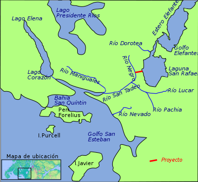
Map of the Isthmus of Ofqui area. In red a 20th-century canal project.
The Antonio de Vea expedition reached the island on December 25, 1675 calling it "Isla San Esteban".[1]
References
- de Vea, Antonio (1886). "Expedición de Antonio de Vea". Anuario Hidrográfico de la Marina de Chile (in Spanish). Valparaíso. p. 573.
This article is issued from Wikipedia. The text is licensed under Creative Commons - Attribution - Sharealike. Additional terms may apply for the media files.