Samrong Thap District
Samrong Thap District (Thai: สำโรงทาบ, pronounced [sǎm.rōːŋ tʰâːp]) is a district (amphoe) in the eastern part of Surin Province, northeastern Thailand.
Samrong Thap สำโรงทาบ | |
|---|---|
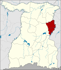 District location in Surin Province | |
| Coordinates: 15°1′21″N 103°56′10″E | |
| Country | Thailand |
| Province | Surin |
| Area | |
| • Total | 375.2 km2 (144.9 sq mi) |
| Population (2005) | |
| • Total | 52,459 |
| • Density | 139.8/km2 (362/sq mi) |
| Time zone | UTC+7 (ICT) |
| Postal code | 32170 |
| Geocode | 3212 |
History
The minor district (king amphoe) Samrong Thap was established on 1 September 1958. It was upgraded to a full district on 11 December 1959.
Geography
Neighboring districts are (from the southwest clockwise): Sikhoraphum, Sanom and Non Narai of Surin Province; Mueang Chan, Huai Thap Than and Prang Ku of Sisaket Province.
Administration
The district is divided into 10 sub-districts (tambons), which are further subdivided into 100 villages (mubans). Samrong Thap is a township (thesaban tambon) which covers parts of tambons Samrong Thap and Nong Phai Lom. There are a further 10 tambon administrative organizations (TAO).
| No. | Name | Thai name | Villages | Pop. | |
|---|---|---|---|---|---|
| 1. | Samrong Thap | สำโรงทาบ | 12 | 6,900 | |
| 2. | Nong Phai Lom | หนองไผ่ล้อม | 13 | 9,538 | |
| 3. | Kra-om | กระออม | 9 | 4,780 | |
| 4. | Nong Ha | หนองฮะ | 11 | 4,939 | |
| 5. | Si Suk | ศรีสุข | 8 | 4,785 | |
| 6. | Ko Kaeo | เกาะแก้ว | 11 | 5,301 | |
| 7. | Muen Si | หมื่นศรี | 9 | 5,494 | |
| 8. | Samet | เสม็จ | 8 | 3,608 | |
| 9. | Sano | สะโน | 9 | 3,318 | |
| 10. | Pradu | ประดู่ | 10 | 3,796 |
Notable people
- Buakaw Banchamek – world-class kickboxer
gollark: Nobody, that's circular logic.
gollark: Become the lord of rapHit all contenders with a bap
gollark: How am I not a computational anarchist?
gollark: Can I be Terrible Garbage, Pleasant *and* Computational Anarchist?
gollark: ++remind 3h :rust:
This article is issued from Wikipedia. The text is licensed under Creative Commons - Attribution - Sharealike. Additional terms may apply for the media files.