Sambava District
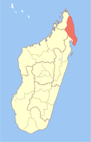
Sambava District is a district in northern Madagascar. It is a part of Sava Region and borders the districts of Antalaha to the south, Andapa to the south-west, Ambilobe to the north-west and Iharana to the north. The area is 4,681.76 km2 (1,808 sq mi) and the population was estimated to be 304,366 in 2013.[1]
Sambava District | |
|---|---|
District | |
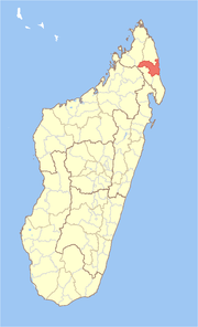 Location in Madagascar | |
| Coordinates: 14°10′S 49°47′E | |
| Country | |
| Region | Sava |
| Area | |
| • Total | 4,681.76 km2 (1,807.64 sq mi) |
| Population (2013) | |
| • Total | 304,366 |
| • Density | 65/km2 (170/sq mi) |
| Time zone | UTC3 (EAT) |
The district is divided into 25 communes.
References and notes
- Institut National de la Statistique, Antananarivo.
gollark: Also kind of buggy?
gollark: Isn't it a spönge plugin?
gollark: Also also the Blogspot of the Linux world.
gollark: Also the Microsoft of the Linux world.
gollark: I would probably just go for the extreme laziness solution and make it just handle floats and round a bit.
This article is issued from Wikipedia. The text is licensed under Creative Commons - Attribution - Sharealike. Additional terms may apply for the media files.