Salt Flat, Texas
Salt Flat is a ghost town in northeastern Hudspeth County, Texas, United States. It lies along the concurrent U.S. Routes 62 and 180 north of the Census-designated place (CDP) of Sierra Blanca, the county seat of Hudspeth County.[1] Its elevation is 3,730 feet (1,137 m).[2] Although Salt Flat is unincorporated, it has a ZIP Code of 79847.[3] The headquarters of the nearby Guadalupe Mountains National Park uses this ZIP Code although it is located closer to Pine Springs, which has no post office.
Salt Flat, Texas | |
|---|---|
 Salt Flat  Salt Flat | |
| Coordinates: 31°44′37″N 105°5′34″W | |
| Country | United States |
| State | Texas |
| County | Hudspeth F |
| Elevation | 3,730 ft (1,140 m) |
| Time zone | UTC−07:00 (Mountain (CST)) |
| • Summer (DST) | UTC−06:00 (MDT) |
| ZIP Code | 79847 |
| GNIS feature ID | 1367427 |
Salt deposits
Just outside the community there is a dry salt pan. The San Elizario Salt War was a dispute over ownership and access to these salt deposits.[4]
gollark: You should complain to someone if it actually goes past you even if you arrive on time.
gollark: My Linux install hibernates fine, without imploding, which is nice.
gollark: Ah, so you are finally switching to the superior OS, then.
gollark: Good* news, PotatOS backend services are back up!
gollark: Breaking changes actually get announced on their news page.
References
- Rand McNally. The Road Atlas '08. Chicago: Rand McNally, 2008, p. 99.
- U.S. Geological Survey Geographic Names Information System: Salt Flat, Texas
- ZIP Code Lookup
- The Salt War of San Elizaro, The Handbook of Texas Online
External links
- Kohout, Martin Donell. Salt Flat, TX, Handbook of Texas Online (accessed December 22, 2012)
- Guadalupe Mountains NP (Official Site) (accessed December 22, 2012)
Municipalities and communities of Hudspeth County, Texas, United States | ||
|---|---|---|
| City | 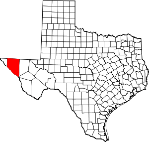 Hudspeth County map | |
| CDPs | ||
| Other unincorporated communities | ||
| Ghost towns | ||
This article is issued from Wikipedia. The text is licensed under Creative Commons - Attribution - Sharealike. Additional terms may apply for the media files.