Sakon Nakhon
Sakon Nakhon (Thai: สกลนคร, pronounced [sā.kōn ná(ʔ).kʰɔ̄ːn]; sometimes written Sakhon Nakhon) is a city (thesaban nakhon) in Thailand within the Isan region, and capital city of Sakon Nakhon Province as well as Mueang Sakon Nakhon District, with a population of approximately 76,000. Sakon Nakhon covers the whole tambon of That Choeng Chum and parts of tambons Ngio Don, Huai Yang, Dong Mafai, That Na Weng and Hang Hong. Sakon Nakhon is 651 km (405 mi) north-east of Bangkok by road.[1]
Sakon Nakhon สกลนคร | |
|---|---|
| City of Sakon Nakhon เทศบาลนครสกลนคร | |
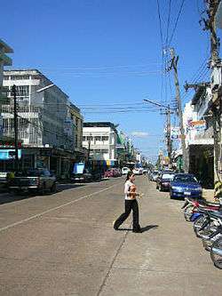 A street in Sakon Nakhon | |
 Seal | |
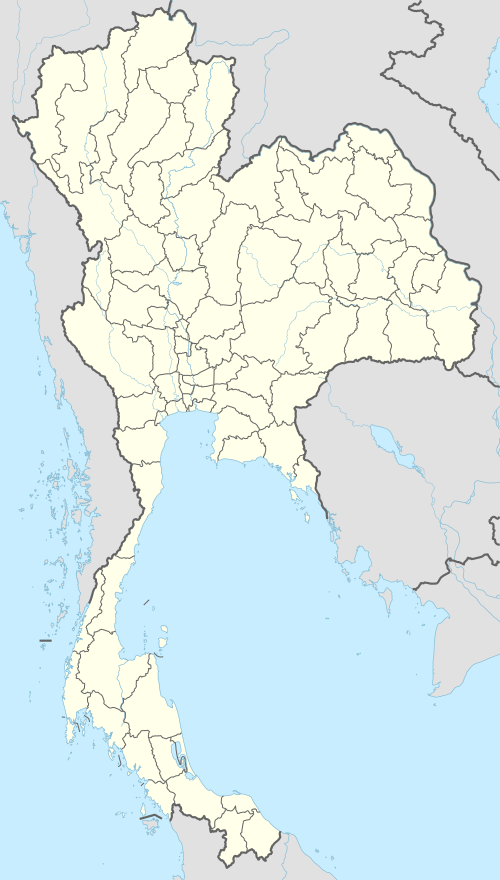 Sakon Nakhon Location in Thailand | |
| Coordinates: 17°9′23″N 104°8′44″E | |
| Country | |
| Province | Sakon Nakhon |
| District | Mueang Sakon Nakhon |
| Government | |
| • Type | City Municipality |
| • Mayor | Komut Teekathananond |
| Area | |
| • Total | 54.54 km2 (21.06 sq mi) |
| Elevation | 175 m (574 ft) |
| Population | 76,000 |
| Time zone | UTC+7 (ICT) |
| Area code | (+66) 42 |
| Website | sakoncity |
History
During World War II, Sakon Nakhon became a haven for Free Thais, and a base for Communist activities in the late 1950s.
Geography
Sakon Nakhon lies on a flat plain at about 175 metres (574 ft) elevation on the south-west bank of Lake Nong Han, the largest lake of north-east Thailand. The town is surrounded by extensive farmland.
Climate
Sakon Nakhon has a tropical savanna climate (Köppen climate classification Aw). Winters are dry and very warm. Temperatures rise until April, which is hot with the average daily maximum at 35.1 °C (95.2 °F). The monsoon season runs from May through October, with heavy rain and somewhat cooler temperatures during the day, although nights remain warm. The lowest temperature ever recorded in Thailand is in Sakon Nakhon when −1.4 °C (29.5 °F) was recorded on 2 January 1974.[2]
| Climate data for Sakon Nakhon (1981–2010) | |||||||||||||
|---|---|---|---|---|---|---|---|---|---|---|---|---|---|
| Month | Jan | Feb | Mar | Apr | May | Jun | Jul | Aug | Sep | Oct | Nov | Dec | Year |
| Record high °C (°F) | 36.2 (97.2) |
38.8 (101.8) |
41.1 (106.0) |
41.8 (107.2) |
41.0 (105.8) |
37.5 (99.5) |
36.6 (97.9) |
36.0 (96.8) |
35.7 (96.3) |
35.0 (95.0) |
36.6 (97.9) |
35.3 (95.5) |
41.8 (107.2) |
| Average high °C (°F) | 29.2 (84.6) |
31.3 (88.3) |
33.7 (92.7) |
35.1 (95.2) |
33.5 (92.3) |
32.5 (90.5) |
31.9 (89.4) |
31.4 (88.5) |
31.4 (88.5) |
31.1 (88.0) |
30.3 (86.5) |
28.6 (83.5) |
31.7 (89.1) |
| Daily mean °C (°F) | 22.1 (71.8) |
24.5 (76.1) |
27.2 (81.0) |
29.1 (84.4) |
28.4 (83.1) |
28.1 (82.6) |
27.7 (81.9) |
27.4 (81.3) |
27.2 (81.0) |
26.4 (79.5) |
24.4 (75.9) |
21.9 (71.4) |
26.2 (79.2) |
| Average low °C (°F) | 16.3 (61.3) |
19.0 (66.2) |
22.1 (71.8) |
24.5 (76.1) |
24.9 (76.8) |
25.2 (77.4) |
24.9 (76.8) |
24.6 (76.3) |
24.2 (75.6) |
22.6 (72.7) |
19.4 (66.9) |
16.1 (61.0) |
22.0 (71.6) |
| Record low °C (°F) | −1.4 (29.5) |
9.5 (49.1) |
7.5 (45.5) |
17.0 (62.6) |
19.8 (67.6) |
22.5 (72.5) |
20.5 (68.9) |
21.7 (71.1) |
20.0 (68.0) |
14.2 (57.6) |
9.1 (48.4) |
4.0 (39.2) |
−1.4 (29.5) |
| Average rainfall mm (inches) | 4.7 (0.19) |
29.3 (1.15) |
57.5 (2.26) |
93.3 (3.67) |
227.6 (8.96) |
266.8 (10.50) |
288.7 (11.37) |
357.9 (14.09) |
224.8 (8.85) |
76.9 (3.03) |
11.9 (0.47) |
5.6 (0.22) |
1,645 (64.76) |
| Average rainy days | 1.3 | 3.8 | 6.0 | 9.9 | 17.2 | 20.2 | 21.3 | 23.7 | 16.6 | 8.5 | 2.3 | 0.7 | 131.5 |
| Average relative humidity (%) | 67 | 65 | 63 | 66 | 76 | 80 | 82 | 84 | 83 | 76 | 70 | 68 | 73 |
| Mean monthly sunshine hours | 272.8 | 243.0 | 275.9 | 243.0 | 198.4 | 156.0 | 120.9 | 117.8 | 183.0 | 235.6 | 252.0 | 272.8 | 2,571.2 |
| Mean daily sunshine hours | 8.8 | 8.6 | 8.9 | 8.1 | 6.4 | 5.2 | 3.9 | 3.8 | 6.1 | 7.6 | 8.4 | 8.8 | 7.0 |
| Source 1: Thai Meteorological Department,[3] (January record low)[2] | |||||||||||||
| Source 2: Office of Water Management and Hydrology, Royal Irrigation Department (sun and humidity)[4] | |||||||||||||
Economy
Fish and rice are two of the major products of the region.
Transportation
Route 22 leads north to Udon Thani, 160 km distant, and east to Nakhon Phanom (91 km) and the border with Laos. Route 223 leads south to That Phanom (76 km). Route 213 leads west to Kalasin (131 km).
There is a regional airport, Sakon Nakhon Airport, on the north side of the city.[5]
Notable People
Notable people born in Sakon Nakthon, and notable residents and ex-residents include:
- Jiranun Sakultangphaisal (born 1965 in Sakon Nakthon), philanthropist
References
- "Distance Bangkok to Sakon Nakhon". Google Maps. Retrieved 24 July 2015.
- "The Climate of Thailand" (PDF). Thai Meteorological Department. Retrieved 31 July 2016.
- "Climatological Data for the Period 1981–2010". Thai Meteorological Department. p. 9. Retrieved 1 August 2016.
- "ปริมาณการใช้น้ำของพืชอ้างอิงโดยวิธีของ Penman Monteith (Reference Crop Evapotranspiration by Penman Monteith)" (PDF) (in Thai). Office of Water Management and Hydrology, Royal Irrigation Department. p. 44. Retrieved 1 August 2016.
- "Sakon Nakhon Airport". OurAirports. Retrieved 3 February 2013.
External links
| Wikimedia Commons has media related to Sakon Nakhon. |
- Official website

- Private page
- Private photo page
- Local events, accommodations, & photo gallery