Saint-Pierre-du-Fresne
Saint-Pierre-du-Fresne is a commune in the Calvados department in the Normandy region in northwestern France.
Saint-Pierre-du-Fresne | |
|---|---|
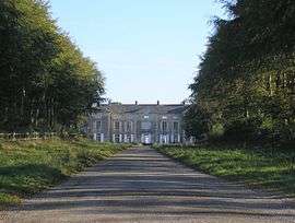 Château du Fresne | |
Location of Saint-Pierre-du-Fresne 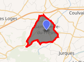
| |
 Saint-Pierre-du-Fresne  Saint-Pierre-du-Fresne | |
| Coordinates: 49°02′09″N 0°45′39″W | |
| Country | France |
| Region | Normandy |
| Department | Calvados |
| Arrondissement | Vire |
| Canton | Aunay-sur-Odon |
| Intercommunality | Pré-Bocage Intercom |
| Government | |
| • Mayor (2008–2014) | Michel Hue |
| Area 1 | 3.43 km2 (1.32 sq mi) |
| Population (2017-01-01)[1] | 195 |
| • Density | 57/km2 (150/sq mi) |
| Time zone | UTC+01:00 (CET) |
| • Summer (DST) | UTC+02:00 (CEST) |
| INSEE/Postal code | 14650 /14260 |
| Elevation | 159–275 m (522–902 ft) (avg. 205 m or 673 ft) |
| 1 French Land Register data, which excludes lakes, ponds, glaciers > 1 km2 (0.386 sq mi or 247 acres) and river estuaries. | |
Population
| Year | Pop. | ±% |
|---|---|---|
| 1962 | 115 | — |
| 1968 | 138 | +20.0% |
| 1975 | 144 | +4.3% |
| 1982 | 127 | −11.8% |
| 1990 | 127 | +0.0% |
| 1999 | 198 | +55.9% |
| 2008 | 200 | +1.0% |
gollark: What might work is dividing the central circle bit into some nice contrasting colors.
gollark: Isn't Pluto in a sort of binary with Charon?
gollark: Maybe a ring around the circle with five bigger points on it? For Pluto I mean.
gollark: A guideline I heard was that a young child of your nation should be able to draw it, though if you have mental enhancements or whatever the bar does go up a bit.
gollark: I think your flag is a bit too complex.
See also
References
- "Populations légales 2017". INSEE. Retrieved 6 January 2020.
| Wikimedia Commons has media related to Saint-Pierre-du-Fresne. |
| Authority control |
|
|---|
This article is issued from Wikipedia. The text is licensed under Creative Commons - Attribution - Sharealike. Additional terms may apply for the media files.