Saint-Pierre-Montlimart
Saint-Pierre-Montlimart is a former commune in the Maine-et-Loire department in western France.
Saint-Pierre-Montlimart | |
|---|---|
Part of Montrevault-sur-Èvre | |
Location of Saint-Pierre-Montlimart 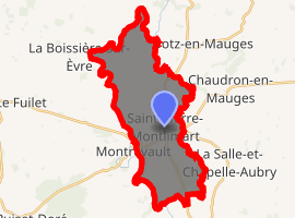
| |
 Saint-Pierre-Montlimart  Saint-Pierre-Montlimart | |
| Coordinates: 47°16′17″N 1°01′32″W | |
| Country | France |
| Region | Pays de la Loire |
| Department | Maine-et-Loire |
| Arrondissement | Cholet |
| Canton | Beaupréau |
| Commune | Montrevault-sur-Èvre |
| Area 1 | 22.29 km2 (8.61 sq mi) |
| Population (2017)[1] | 3,300 |
| • Density | 150/km2 (380/sq mi) |
| Time zone | UTC+01:00 (CET) |
| • Summer (DST) | UTC+02:00 (CEST) |
| Postal code | 49110 |
| Elevation | 12–106 m (39–348 ft) (avg. 87 m or 285 ft) |
| 1 French Land Register data, which excludes lakes, ponds, glaciers > 1 km2 (0.386 sq mi or 247 acres) and river estuaries. | |
Geography
The commune is traversed by the Èvre river.
History
On 15 December 2015, La Boissière-sur-Èvre, Chaudron-en-Mauges, La Chaussaire, Le Fief-Sauvin, Le Fuilet, Montrevault, Le Puiset-Doré, Saint-Pierre-Montlimart, Saint-Quentin-en-Mauges, Saint-Rémy-en-Mauges and La Salle-et-Chapelle-Aubry merged becoming one commune called Montrevault-sur-Èvre.
gollark: Stop doing that?
gollark: Anyway, I can't just set my beliefs to arbitrary things. Especially things contradicted by reality.
gollark: Cognitive dissonance IRL.
gollark: I can't start believing gravity goes up or something.
gollark: At least, not all of them.
References
| Wikimedia Commons has media related to Saint-Pierre-Montlimart. |
| Authority control |
|
|---|
This article is issued from Wikipedia. The text is licensed under Creative Commons - Attribution - Sharealike. Additional terms may apply for the media files.