La Salle-et-Chapelle-Aubry
La Salle-et-Chapelle-Aubry is a former commune in the Maine-et-Loire department in western France.
La Salle-et-Chapelle-Aubry | |
|---|---|
Part of Montrevault-sur-Èvre | |
Location of La Salle-et-Chapelle-Aubry 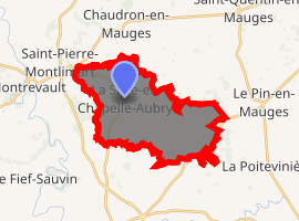
| |
 La Salle-et-Chapelle-Aubry  La Salle-et-Chapelle-Aubry | |
| Coordinates: 47°15′21″N 0°59′05″W | |
| Country | France |
| Region | Pays de la Loire |
| Department | Maine-et-Loire |
| Arrondissement | Cholet |
| Canton | Beaupréau |
| Commune | Montrevault-sur-Èvre |
| Area 1 | 18.76 km2 (7.24 sq mi) |
| Population (2017)[1] | 1,349 |
| • Density | 72/km2 (190/sq mi) |
| Demonym(s) | Aubryen, Aubryenne |
| Time zone | UTC+01:00 (CET) |
| • Summer (DST) | UTC+02:00 (CEST) |
| Postal code | 49110 |
| Elevation | 43–121 m (141–397 ft) (avg. 105 m or 344 ft) |
| 1 French Land Register data, which excludes lakes, ponds, glaciers > 1 km2 (0.386 sq mi or 247 acres) and river estuaries. | |
History
On 15 December 2015, La Boissière-sur-Èvre, Chaudron-en-Mauges, La Chaussaire, Le Fief-Sauvin, Le Fuilet, Montrevault, Le Puiset-Doré, Saint-Pierre-Montlimart, Saint-Quentin-en-Mauges, Saint-Rémy-en-Mauges and La Salle-et-Chapelle-Aubry merged becoming one commune called Montrevault-sur-Èvre.
gollark: The closest thing to a science fair my school did is one night last year or something where everyone presented DT (design and technology) projects.
gollark: It's not a battle competition, so I don't know *why* you would do that.
gollark: The competition rules for the one we do *explicitly say* that your robot may not be on fire, oddly.
gollark: Some of the non-programming people are doing hardware design somewhat, which is useful.
gollark: Only the computer science cohort of not many people is doing it, but due to scheduling only about 3 of us actually have significant programming experience.
References
| Wikimedia Commons has media related to La Salle-et-Chapelle-Aubry. |
| Authority control |
|
|---|
This article is issued from Wikipedia. The text is licensed under Creative Commons - Attribution - Sharealike. Additional terms may apply for the media files.