Saint-Pierre-Église
Saint-Pierre-Église is a commune in the Manche department in Normandy in north-western France.
Saint-Pierre-Église | |
|---|---|
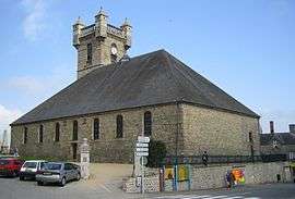 The church in Saint-Pierre-Église | |
.svg.png) Coat of arms | |
Location of Saint-Pierre-Église 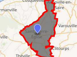
| |
 Saint-Pierre-Église  Saint-Pierre-Église | |
| Coordinates: 49°40′09″N 1°24′10″W | |
| Country | France |
| Region | Normandy |
| Department | Manche |
| Arrondissement | Cherbourg |
| Canton | Val-de-Saire |
| Intercommunality | CA Cotentin |
| Government | |
| • Mayor (2008–2014) | Christine Labacheley |
| Area 1 | 8.06 km2 (3.11 sq mi) |
| Population (2017-01-01)[1] | 1,803 |
| • Density | 220/km2 (580/sq mi) |
| Time zone | UTC+01:00 (CET) |
| • Summer (DST) | UTC+02:00 (CEST) |
| INSEE/Postal code | 50539 /50330 |
| Elevation | 4–138 m (13–453 ft) (avg. 110 m or 360 ft) |
| 1 French Land Register data, which excludes lakes, ponds, glaciers > 1 km2 (0.386 sq mi or 247 acres) and river estuaries. | |
A market takes place in Saint-Pierre-Église every Wednesday.
WW2: Part of the Allied invasion happened here in 1944.
International relations
gollark: Including yourself?
gollark: If potatOS contains antimemetic bees I don't know about them.
gollark: The privacy policy *isn't* restrictive, and it maybe isn't GDPR-compliant.
gollark: It's based on ye olden particles.js but modernized.
gollark: You can\* turn off potatOS remote debugging if you care that much, but we have a good\*\* privacy\*\*\* policy\*\*\*\*!
See also
References
- "Populations légales 2017". INSEE. Retrieved 6 January 2020.
- "British towns twinned with French towns [via WaybackMachine.com]". Archant Community Media Ltd. Archived from the original on 5 July 2013. Retrieved 2013-07-20.
| Wikimedia Commons has media related to Saint-Pierre-Église. |
| Authority control |
|
|---|
This article is issued from Wikipedia. The text is licensed under Creative Commons - Attribution - Sharealike. Additional terms may apply for the media files.