Saint-Isidore Parish, New Brunswick
Saint-Isidore is a civil parish[lower-alpha 1] in Gloucester County, New Brunswick, Canada. For governance purposes it is divided between the Regional Municipality of Tracadie, the village of Saint-Isidore, and the local service district of the parish of Saint-Isidore,[lower-alpha 2] which further includes the special service area of Bois-Blanc - Hacheyville - Duguayville.
Saint-Isidore St. Isidore | |
|---|---|
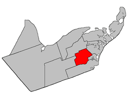 Location within Gloucester County, New Brunswick | |
| Coordinates: 47.57°N 65.14°W | |
| Country | |
| Province | |
| County | Gloucester |
| Established | 1881 |
| Area | |
| • Land | 173.25 km2 (66.89 sq mi) |
| Population (2016)[1] | |
| • Total | 1,361 |
| • Density | 7.9/km2 (20/sq mi) |
| • Change 2011-2016 | |
| • Dwellings | 658 |
| Time zone | UTC-4 (AST) |
| • Summer (DST) | UTC-3 (ADT) |
Delineation
Saint-Isidore Parish is defined in the Territorial Division Act[2] as being bounded:
- Beginning at a point on the northern bank or shore of the Little Tracadie River at a point where the western limit of lot number thirty, granted to Richard Arseneault, intersects the same; thence northerly along said limit and said limit of lot number two hundred and eighty-nine, granted to Canute Arceno, Second Tier, north of said river, to a point in the south limit of Range six, Saint-Isidore [Settlement]; thence in an easterly direction along said limit of said Range to the southeast angle of lot number one, granted to T. Richard; thence in a northerly direction along the east limit of said lot to the southwest corner of lot number three hundred and nine, granted to A. Basque; thence in an easterly direction along the southern limit of said lot and said limit of lot number three hundred and six, granted to George Savoy, and lot number one hundred and forty-two, granted to M. Gottro, to a point in the west bank or shore of Gaspereau Creek; thence in a northerly direction along said bank or shore to a point where the same is intersected by the south limit of lot number one hundred and forty-four, granted to Dos. Landry; thence in an easterly direction along said limit of said lot to the southeast angle of the same; thence northwesterly in a direct line to the southwest angle of lot number five, granted to Jos. Lavigne, Range Six, Val-Doucet [Settlement]; thence in a westerly direction along the south limit of said Range Six to the northwest angle of lot number nine, Range A, Saint-Isidore; thence in a southerly direction along the west limit of said lot to a point in the division line between said Range A and Range 1, Saint-Isidore; thence in a westerly direction along said division line to the northwest angle of lot number two hundred and sixteen in said Range One of Saint-Isidore; thence in a southerly direction along the west limit of said lot in Ranges One, Two, Three and Four, Saint-Isidore, to a point in the division line between said Range Four and Range Five of Saint-Isidore; thence in a westerly direction along said division line to the northwest angle of lot number two hundred and twenty-five in said Range Five of Saint-Isidore; thence in a southerly direction along the west limit of said lot and the southern prolongation of same to a point in the western prolongation of the south limit of Range Nine, Saint-Isidore; thence in an easterly direction along said prolongation and said limit to a point in the eastern bank or shore of the Little Tracadie River; and thence following the various courses thereof downstream to the point of beginning.
Communities
Parish population total does not include incorporated municipalities (in bold):
|
|
Demographics
Population
|
LanguageMother tongue (2016)[1]
|
gollark: You may only ask dishonest questions.
gollark: VPNs prevent ISPs from seeing all this except possibly to some extent #3, but the VPN provider can still see it, and obviously whatever service you connect to has any information sent to it.
gollark: Anyway, with HTTPS being a thing basically everywhere and DNS over HTTPS existing, ISPs can only see:- unencrypted traffic from programs/services which don't use HTTPS or TLS- the *domains* you visit (*not* pages, and definitely not their contents, just domains) - DNS over HTTPS doesn't prevent this because as far as I know it's still in plaintext in HTTPS requestts- metadata about your connection/packets/whatever- also the IPs you visit, but the domains are arguably more useful anyway
gollark: On my (GNU/)Linux computing devices, which is all of my non-portable ones, I run dnscrypt-proxy, which acts as a local DNS server which runs my queries through DNS over HTTPS/DNS over TLS/DNSCrypt servers.
gollark: In other news, the first rule of tautology club is the first rule of tautology club.
See also
Notes
- Civil parishes served a variety of government functions until 1966, when the new Municipalities Act stripped them of their responsibilities; they continue to provide convenient boundaries for government uses, especially electoral districts and local service districts. Statistics Canada uses civil parishes as census subdivisions for all parts of the province that are not within municipalities and similar entities.
- The LSD of the parish of Saint-Isidore extends into Paquetville Parish, Saint-Isidore Parish does not.
References
- "Census Profile, 2016 Census: Saint-Isidore, Parish [Census subdivision], New Brunswick". Statistics Canada. Retrieved September 10, 2019.
- "Territorial Division Act (R.S.N.B. 1973, c. T-3)". Government of New Brunswick website. Retrieved August 26, 2016.
- Statistics Canada: 1996, 2001, 2006 census
- 2011 Statistics Canada Census Profile: Saint-Isidore Parish, New Brunswick
Places adjacent to Saint-Isidore Parish, New Brunswick | ||||||||||
|---|---|---|---|---|---|---|---|---|---|---|
| ||||||||||
| Subdivisions |
|
|---|---|
| Cities | |
| Counties | |
| |
This article is issued from Wikipedia. The text is licensed under Creative Commons - Attribution - Sharealike. Additional terms may apply for the media files.