Saint-Dominique, Quebec
Saint-Dominique is a municipality in the Montérégie region of southwestern Quebec. The population as of the Canada 2011 Census was 2,327.
Saint-Dominique | |
|---|---|
Municipality | |
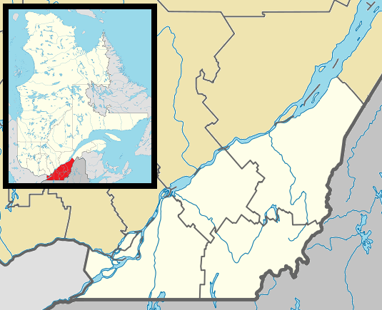
 Location within Les Maskoutains RCM. | |
 Saint-Dominique Location in southern Quebec. | |
| Coordinates: 45°34′N 72°51′W[1] | |
| Country | |
| Province | |
| Region | Montérégie |
| RCM | Les Maskoutains |
| Constituted | July 1, 2017 |
| Government | |
| • Mayor | Mario Beauchemin |
| • Federal riding | Saint-Hyacinthe—Bagot |
| • Prov. riding | Saint-Hyacinthe |
| Area | |
| • Total | 71.10 km2 (27.45 sq mi) |
| • Land | 69.08 km2 (26.67 sq mi) |
| Population (2017)[4] | |
| • Total | 2,327 |
| • Density | 33.7/km2 (87/sq mi) |
| • Pop 2006-2011 | |
| • Dwellings | 943 |
| Time zone | UTC−5 (EST) |
| • Summer (DST) | UTC−4 (EDT) |
| Postal code(s) | J0H 1L0 |
| Area code(s) | 450 and 579 |
| Highways | |
| Website | www.municipalite. saint-dominique.qc.ca |
Demographics
Population
| Canada census – Saint-Dominique, Quebec community profile | |||
|---|---|---|---|
| 2011 | 2006 | ||
| Population: | 2,327 (+9.1% from 2006) | 2,132 (-4.4% from 2001) | |
| Land area: | 69.08 km2 (26.67 sq mi) | 69.08 km2 (26.67 sq mi) | |
| Population density: | 33.7/km2 (87/sq mi) | 30.9/km2 (80/sq mi) | |
| Median age: | 37.1 (M: 37.5, F: 36.9) | 36.3 (M: 36.3, F: 36.2) | |
| Total private dwellings: | 943 | 850 | |
| Median household income: | $61,438 | $51,680 | |
| References: 2011[4] 2006[5] earlier[6] | |||
|
|
|
Language
| Canada Census Mother Tongue - Saint-Dominique, Quebec[7] | ||||||||||||||||||
|---|---|---|---|---|---|---|---|---|---|---|---|---|---|---|---|---|---|---|
| Census | Total | French |
English |
French & English |
Other | |||||||||||||
| Year | Responses | Count | Trend | Pop % | Count | Trend | Pop % | Count | Trend | Pop % | Count | Trend | Pop % | |||||
2011 |
2,325 |
2,280 | 98.06% | 20 | 0.86% | 10 | 0.43% | 15 | 0.65% | |||||||||
2006 |
2,115 |
2,075 | 98.11% | 20 | 0.95% | 10 | 0.47% | 10 | 0.47% | |||||||||
2001 |
2,220 |
2,195 | 98.87% | 25 | 1.13% | 0 | 0.00% | 0 | 0.00% | |||||||||
1996 |
2,245 |
2,215 | n/a | 98.66% | 10 | n/a | 0.45% | 0 | n/a | 0.00% | 20 | n/a | 0.89% | |||||
gollark: It has a nice "portal to hell"-y aesthetic to it what with all the red.
gollark: "Once"? Wasn't that yesterday?
gollark: Hey, I'm not saying I'm not.
gollark: You're vaguely "privileged" in that you're in a country which can afford to do that.
gollark: Also, I suspect most people don't actually care very much. I mean, abstractly, if you ask people "would you like people to not get malaria/be cured of malaria", they'll say yes. But people generally do *not* really care enough to actually pay the various charities which are able to provide malaria nets and stuff, despite these being extremely effective at lives saved per $.
See also
References
- Reference number 55927 of the Commission de toponymie du Québec (in French)
- Ministère des Affaires municipales, des Régions et de l'Occupation du territoire: Saint-Dominique
- Parliament of Canada Federal Riding History: SAINT-HYACINTHE--BAGOT (Quebec)
- "2011 Community Profiles". 2011 Canadian Census. Statistics Canada. July 5, 2013. Retrieved 2014-03-18.
- "2006 Community Profiles". 2006 Canadian Census. Statistics Canada. March 30, 2011. Retrieved 2014-03-18.
- "2001 Community Profiles". 2001 Canadian Census. Statistics Canada. February 17, 2012.
- Statistics Canada: 1996, 2001, 2006, 2011 census
Adjacent Municipal Subdivisions | ||||||||||
|---|---|---|---|---|---|---|---|---|---|---|
| ||||||||||
| Cities |
|
|---|---|
| Municipalities | |
| Parishes | |
| Villages | |
| |
This article is issued from Wikipedia. The text is licensed under Creative Commons - Attribution - Sharealike. Additional terms may apply for the media files.