Saint-Clair, Vienne
Saint-Clair is a commune in the Vienne department in the Nouvelle-Aquitaine region in western France.
Saint-Clair | |
|---|---|
Location of Saint-Clair 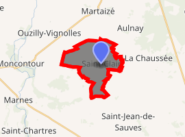
| |
 Saint-Clair  Saint-Clair | |
| Coordinates: 46°52′54″N 0°03′50″E | |
| Country | France |
| Region | Nouvelle-Aquitaine |
| Department | Vienne |
| Arrondissement | Châtellerault |
| Canton | Loudun |
| Intercommunality | Pays Loudunais |
| Government | |
| • Mayor | Didier Rambeau |
| Area 1 | 10.67 km2 (4.12 sq mi) |
| Population (2017-01-01)[1] | 196 |
| • Density | 18/km2 (48/sq mi) |
| Time zone | UTC+01:00 (CET) |
| • Summer (DST) | UTC+02:00 (CEST) |
| INSEE/Postal code | 86218 /86330 |
| Elevation | 57–82 m (187–269 ft) (avg. 75 m or 246 ft) |
| 1 French Land Register data, which excludes lakes, ponds, glaciers > 1 km2 (0.386 sq mi or 247 acres) and river estuaries. | |
Demographics
| Year | 1962 | 1968 | 1975 | 1982 | 1990 | 1999 | 2006 |
|---|---|---|---|---|---|---|---|
| Population | 257 | 298 | 268 | 238 | 208 | 188 | 201 |
gollark: According to the potatOS privacy policy, history/time is fixed and there are no inconsistencies.
gollark: SCP-████ and the potatOS privacy policy.
gollark: Yes, legally.
gollark: my age is negative zero point four four four four seven nine picoaeons.
gollark: yes.
See also
References
- "Populations légales 2017". INSEE. Retrieved 6 January 2020.
| Wikimedia Commons has media related to Saint-Clair (Vienne). |
| Authority control |
|
|---|
This article is issued from Wikipedia. The text is licensed under Creative Commons - Attribution - Sharealike. Additional terms may apply for the media files.