Saint-Étienne-sous-Barbuise
Saint-Étienne-sous-Barbuise is a commune in the Aube department in north-central France.
Saint-Étienne-sous-Barbuise | |
|---|---|
Location of Saint-Étienne-sous-Barbuise 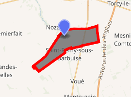
| |
 Saint-Étienne-sous-Barbuise  Saint-Étienne-sous-Barbuise | |
| Coordinates: 48°30′03″N 4°06′36″E | |
| Country | France |
| Region | Grand Est |
| Department | Aube |
| Arrondissement | Troyes |
| Canton | Arcis-sur-Aube |
| Government | |
| • Mayor (2008–2014) | Claude Viseur |
| Area 1 | 10.84 km2 (4.19 sq mi) |
| Population (2017-01-01)[1] | 167 |
| • Density | 15/km2 (40/sq mi) |
| Time zone | UTC+01:00 (CET) |
| • Summer (DST) | UTC+02:00 (CEST) |
| INSEE/Postal code | 10338 /10700 |
| Elevation | 98–140 m (322–459 ft) (avg. 100 m or 330 ft) |
| 1 French Land Register data, which excludes lakes, ponds, glaciers > 1 km2 (0.386 sq mi or 247 acres) and river estuaries. | |
Population
| Year | Pop. | ±% |
|---|---|---|
| 1962 | 129 | — |
| 1968 | 154 | +19.4% |
| 1975 | 144 | −6.5% |
| 1982 | 147 | +2.1% |
| 1990 | 117 | −20.4% |
| 1999 | 118 | +0.9% |
| 2008 | 134 | +13.6% |
| 2012 | 144 | +7.5% |
gollark: Which is totally high resolution enough to map the entire thing well enough to emulate near-perfectly.
gollark: It's probably easier.
gollark: If you can somehow replace a clump of neurons with a perfect emulation fast enough it probably wouldn't cause a problem.
gollark: It still *works*, but those things cause problems.
gollark: The idea of the gradual uploading thing is to flip bits over to the computerized version rapidly to avoid that, but it still has lots of the problems.
See also
References
- "Populations légales 2017". INSEE. Retrieved 6 January 2020.
| Wikimedia Commons has media related to Saint-Étienne-sous-Barbuise. |
| Authority control |
|
|---|
This article is issued from Wikipedia. The text is licensed under Creative Commons - Attribution - Sharealike. Additional terms may apply for the media files.