Sadu (Cibin)
The Sadu (Hungarian: Cód) is a right tributary of the river Cibin in Romania.[1][2] It discharges into the Cibin in Tălmaciu. The Negovanu and Sadu II dams are located on the Sadu. Its length is 60 km (37 mi) and its basin size is 278 km2 (107 sq mi).[2]
| Sadu | |
|---|---|
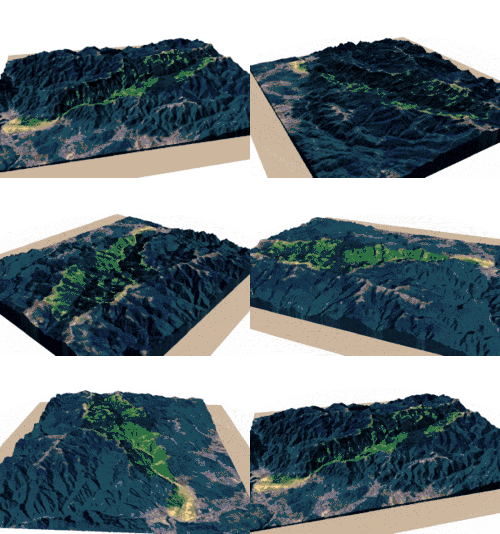
 Sadu drainage basin | |
| Location | |
| Country | Romania |
| Counties | Sibiu County |
| Villages | Râu Sadului, Sadu, Tălmaciu |
| Physical characteristics | |
| Source | Cindrel Mountains |
| Mouth | Cibin |
• location | Tălmaciu |
• coordinates | 45.6599°N 24.2666°E |
| Length | 60 km (37 mi) |
| Basin size | 278 km2 (107 sq mi) |
| Discharge | |
| • location | * |
| • average | 3.74 m3/s (132 cu ft/s) |
| Basin features | |
| Progression | Cibin→ Olt→ Danube→ Black Sea |
| Tributaries | |
| • right | Sădurel |
Tributaries
The following rivers are tributaries to the river Sadu (from source to mouth):
- Left: Cânaia, Șerbănei, Rozdești, Dușa, Beșineu, Bătrâna, Valea Groșilor, Valea Cândii, Sașa, Valea Vârjoghii, Valea Bonții, Ciupari, Valea Hotarelor, Cârligele, Pârâul Rece, Valea Casei
- Right: Conțu, Negovanu, Valea Pitarului, Valea Doamnei, Sădurel, Valea lui Ivan, Drăgăneasa, Valea lui Roman, Puntea, Mancu, Prejba, Obrești, Lacul, Valea Plaiului, Juvertul, Mesteacănu, Varul, Priboiu
gollark: Well, not insanely, just quite expensive.
gollark: You can travel by train to London, except it's insanely expensive.
gollark: Not sure where you'd expect it to get the times from, though.
gollark: I can probably program something if you're specific about your requirements.
gollark: There are projects you could do which might *actually* be useful and not too hard to do, and you should consider those instead of trying to blindly ape Windows and stuff for the 129712815261th CC OS.
References
- "Planul național de management. Sinteza planurilor de management la nivel de bazine/spații hidrografice, anexa 7.1" (PDF, 5.1 MB). Administrația Națională Apele Române. 2010. pp. 696–697.
- Atlasul cadastrului apelor din România. Partea 1 (in Romanian). Bucharest: Ministerul Mediului. 1992. p. 291. OCLC 895459847. River code: VIII.1.120.14
This article is issued from Wikipedia. The text is licensed under Creative Commons - Attribution - Sharealike. Additional terms may apply for the media files.