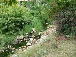
Sărata (Ialomița)
The Sărata is a left tributary of the river Ialomița in Romania.[1][2] It discharges into the Ialomița in Urziceni. It flows through the villages Sărata-Monteoru, Ulmeni, Movila Banului, Mihăilești, Glodeanu Sărat and Armășești. Its length is 72 km (45 mi) and its basin size is 1,290 km2 (500 sq mi).[2]
| Sărata | |
|---|---|
 | |
| Location | |
| Country | Romania |
| Counties | Buzău, Ialomița |
| Physical characteristics | |
| Mouth | Ialomița |
• location | Urziceni |
• coordinates | 44.7085°N 26.6230°E |
| Length | 72 km (45 mi) |
| Basin size | 1,290 km2 (500 sq mi) |
| Basin features | |
| Progression | Ialomița→ Danube→ Black Sea |
Tributaries
The following rivers are tributaries to the river Sărata (from source to mouth):[2]
gollark: I am very easily bored.
gollark: I bet I could catch a few poorly programmed ones with some work, though.
gollark: It looks like the exploit bots I decided to have fun with by streaming osmarks internet radio™ at are just dropping the connection when I do that. Sad!
gollark: Visit osmarks.tk, so I can somewhat obsessively analyze your traffic™.
gollark: And someone on something which... inconclusively looks like Safari and Chrome on an Android device, but is also seemingly an actual browser... visited SPUDNET, but didn't log in.
References
- "Planul național de management. Sinteza planurilor de management la nivel de bazine/spații hidrografice, anexa 7.1" (PDF, 5.1 MB). Administrația Națională Apele Române. 2010. p. 874.
- Atlasul cadastrului apelor din România. Partea 1 (in Romanian). Bucharest: Ministerul Mediului. 1992. pp. 356–357. OCLC 895459847. River code: XI.1.22
This article is issued from Wikipedia. The text is licensed under Creative Commons - Attribution - Sharealike. Additional terms may apply for the media files.