Sèche Island
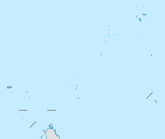
It lies 1.5 km of the eastern point of Ste. Anne Island, and 7.5 km from Mahe. and reaches an elevation of 30 meters. Small, rocky, boulder-strewn and uninhabited, it is the nesting ground of sea-gulls. The island is a granite rock on top of which some low growing trees.
| Native name: Beacon Island Nickname: Île Sèche | |
|---|---|
 Sèche Island | |
| Geography | |
| Location | Seychelles, Indian Ocean |
| Coordinates | 4°36′S 55°31′E |
| Archipelago | Inner Islands, Seychelles |
| Adjacent bodies of water | Indian Ocean |
| Total islands | 1 |
| Major islands |
|
| Area | 0.02 km2 (0.0077 sq mi) |
| Length | 0.16 km (0.099 mi) |
| Width | 0.11 km (0.068 mi) |
| Coastline | 0.63 km (0.391 mi) |
| Highest elevation | 30 m (100 ft) |
| Highest point | Beacon peak |
| Administration | |
| Group | Granitic Seychelles |
| Sub-Group | Mahe Islands |
| Sub-Group | St. Anne Islands |
| Districts | Mont Fleuri |
| Demographics | |
| Population | 0 (2014) |
| Pop. density | 0/km2 (0/sq mi) |
| Ethnic groups | Creole, French, East Africans, Indians. |
| Additional information | |
| Time zone | |
| ISO code | SC-18 |
| Official website | www |
Île Sèche is an islet in Seychelles.
The tiny island is also known as Beacon island.
About 2.15 km to its south lies some granite rocks called Harrison Rocks, 0.30 acres in size.
Image gallery
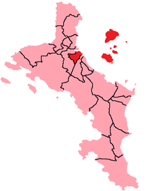 District Map
 Beacon island, Ile Seche
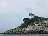
gollark: (integrate it into the existing selectors as appropriate)
gollark: The GEORGE iframe.
gollark: GEORGE CSS suggestions:```csshtml { box-sizing: border-box }main { height: 50px }```
gollark: I don't know if it's fixable without JS.
gollark: How will our mobile users acquiesce utterly?
References
This article is issued from Wikipedia. The text is licensed under Creative Commons - Attribution - Sharealike. Additional terms may apply for the media files.