São João Baptista (Santo Antão)
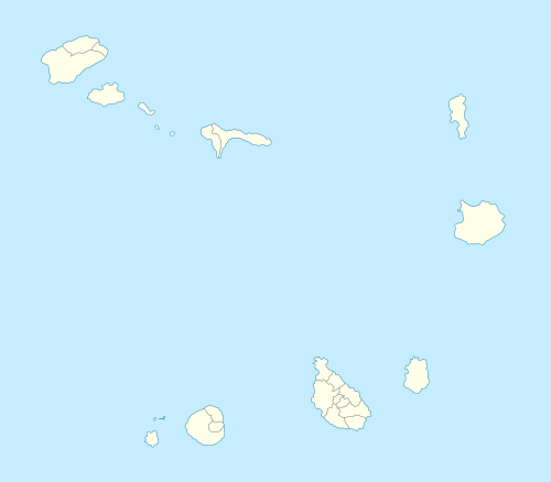
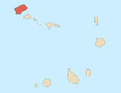
São João Baptista is a freguesia (civil parish) of Cape Verde. It covers the larger, southern part of the municipality of Porto Novo, on the island of Santo Antão.
São João Baptista | |
|---|---|
Civil parish | |
 São João Baptista | |
| Coordinates: 17.02°N 25.18°W | |
| Country | Cape Verde |
| Island | Santo Antão |
| Municipality | Porto Novo |
| Population (2010)[1] | |
| • Total | 14,465 |
| ID | 131 |
Subdivisions
The freguesia consists of the following settlements (population at the 2010 census):
- Agua dos Velhos (pop: 60)
- Bolona (pop: 112)
- Casa do Meio (pop: 36)
- Catano (pop: 266)
- Chã de Morte (pop: 746)
- Cirio (pop: 476)
- Curral das Vacas (pop: 335)
- João Bento/Ribeira dos Bodes (pop: 162)
- Lagoa (pop: 358)
- Lagoa de Catano (pop: 257)
- Lajedo (pop: 558)
- Lombo das Lanças (pop: 40)
- Lombo de Figueira (pop: 281)
- Manuel Lopes (pop: 43)
- Mato Estreito (pop: 58)
- Morro Vento (pop: 107)
- Pedra de Jorge (pop: 55)
- Pico da Cruz (pop: 101)
- Porto Novo (pop: 9,310, city)[2]
- Ribeira Fria (pop: 198)
- Ribeira Torta (pop: 11)
- Ribeirão Fundo (pop: 45)
- Tabuga (pop: 9)
- Tarrafal de Monte Trigo (pop: 841)
gollark: I mean, intense abstract things may be out of reach for bored teenagers being taught maths at school.
gollark: ... because if people don't have intuition for the thing, they may just do badly at it and complain?
gollark: Initially.
gollark: They presumably want to teach things which people have more intuition for.
gollark: It's not just that.
References
- "2010 Census results". Instituto Nacional de Estatística Cabo Verde (in Portuguese). 24 November 2016.
- Cabo Verde, Statistical Yearbook 2015, Instituto Nacional de Estatística, p. 32-33
This article is issued from Wikipedia. The text is licensed under Creative Commons - Attribution - Sharealike. Additional terms may apply for the media files.
