Rush River (Virginia)
The Rush River is a 12.5-mile-long (20.1 km)[1] river in the U.S. state of Virginia. It rises in the northern part of Shenandoah National Park and flows southeast to the Thornton River at Rock Mills. Via the Thornton and Hazel rivers, it is part of the Rappahannock River watershed.
| Rush River (Virginia) | |
|---|---|
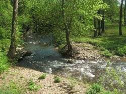 The Rush River near the Calvert Mill in Washington, Virginia | |
| Location | |
| Country | United States |
| Physical characteristics | |
| Source | |
| • location | Virginia |
See also
References
- U.S. Geological Survey. National Hydrography Dataset high-resolution flowline data. The National Map, accessed April 1, 2011
- U.S. Geological Survey Geographic Names Information System: Rush River
- USGS Hydrologic Unit Map - State of Virginia (1974)
- Salmon, Emily J.; Campbell, Jr., Edward D. C. (1994). The Hornbook of Virginia History (4th ed.). Richmond, VA: Virginia Office of Graphic Communications. ISBN 0-88490-177-7.
This article is issued from Wikipedia. The text is licensed under Creative Commons - Attribution - Sharealike. Additional terms may apply for the media files.