Route Napoléon
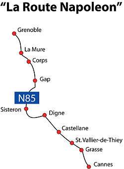
The Route Napoléon is the route taken by Napoléon in 1815 on his return from Elba. It is now concurrent with sections of routes N85, D1085, D4085, and D6085.
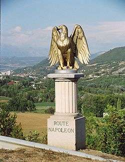
Gilded eagle marker along the Route Napoléon, on the southern approach to Gap, Hautes-Alpes
The Route Napoléon
The route begins at Golfe-Juan, where Napoleon disembarked 1 March 1815, beginning the Hundred Days that ended at Waterloo. The road was inaugurated in 1932 and meanders from the French Riviera north-northwest along the foothills of the Alps. It is marked along the way by statues of the French Imperial Eagle.
Route
From south to north:
Gallery
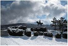 Route Napoleon, Prairie de la Rencontre, Laffrey, France
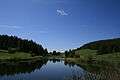 Lake on the Col Bayard
gollark: Use binary and with stuff like 0xFF0000 (to get red), 0x00FF00 (to get green) and 0x0000FF (for blue).
gollark: Doesn't blink.
gollark: All hail Squid, Bringer of Plethora.
gollark: <:neuralinterface:478293474047819777> <:frickinlaserbeam:478293474492547072> 🐟 = laser shark
gollark: https://wiki.computercraft.cc/Network_security^Useful tips on security in networking. Written by me and then edited a lot by lignum.
External links
| Wikisource has original text related to this article: |

This article is issued from Wikipedia. The text is licensed under Creative Commons - Attribution - Sharealike. Additional terms may apply for the media files.