Round O, South Carolina
Round O (formerly also called Round) is an unincorporated community in Colleton County, South Carolina, United States. Its elevation is 36 feet (11 m).[1] It is located near the intersection of Cottageville Highway (U.S. Route 17) and Round O Road.
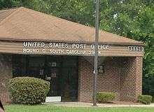
Round O, South Carolina Post Office on July 5, 2015
According to tradition, the community received its name from a local Native American whose name was too long to pronounce, hence the name Round O, and painted his torso with a circular design.[2]
On J. G. W. De Brahm's 1757 "Map of South Carolina and a Part of Georgia," a round geographical feature labeled "Round O Savannah" is clearly visible west of the Edisto River in St. Bartholomew's Parish.[3]
References
- U.S. Geological Survey Geographic Names Information System: Round O, South Carolina
- "Some towns sure have funny names". The Miami News. pp. 4A. Retrieved May 19, 2015.
- De Brahm, John Gerar William. "A map of South Carolina and a Part of Georgia" (Map). "A Map of South Carolina and a Part of Georgia" (London : Thomas Jefferys, 1757). Retrieved June 15, 2018.
Municipalities and communities of Colleton County, South Carolina, United States | ||
|---|---|---|
| City | 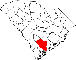 Map of South Carolina highlighting Colleton County | |
| Towns | ||
| CDPs | ||
| Unincorporated communities | ||
This article is issued from Wikipedia. The text is licensed under Creative Commons - Attribution - Sharealike. Additional terms may apply for the media files.