Rouez
Rouez, also called Rouez-en-Champagne, is a commune in the Sarthe department in the region of Pays de la Loire in north-western France.
Rouez-en-Champagne | |
|---|---|
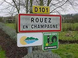
 A road sign at the entrance to Rouez | |
.svg.png) Coat of arms | |
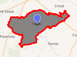
Location of Rouez-en-Champagne 
| |
 Rouez-en-Champagne  Rouez-en-Champagne | |
| Coordinates: 48°08′25″N 0°06′46″W | |
| Country | France |
| Region | Pays de la Loire |
| Department | Sarthe |
| Arrondissement | Mamers |
| Canton | Sillé-le-Guillaume |
| Intercommunality | Champagne Conlinoise et Pays de Sillé |
| Government | |
| • Mayor (2008–2014) | Paul Melot |
| Area 1 | 33.65 km2 (12.99 sq mi) |
| Population (2017-01-01)[1] | 771 |
| • Density | 23/km2 (59/sq mi) |
| Demonym(s) | Rouéziens |
| Time zone | UTC+01:00 (CET) |
| • Summer (DST) | UTC+02:00 (CEST) |
| INSEE/Postal code | 72256 /72140 |
| Elevation | 92–171 m (302–561 ft) |
| 1 French Land Register data, which excludes lakes, ponds, glaciers > 1 km2 (0.386 sq mi or 247 acres) and river estuaries. | |
Geography
The village lies in the middle of the commune, on the left bank of the Merdereau, a left tributary of the Vègre, which flows southeastward through the commune.
gollark: You're going to blame it on capitalism. I'm pretty sure you're wrong.
gollark: But we probably can't because humans are bad.
gollark: Preferably we would get rid of the weird and inefficient prejudice against him and others.
gollark: As general wealth increases over time it'll be possible to do more and more stuff with some level of basic income.
gollark: Anyway, expect slower replies, I'm going on my phone.
See also
References
- "Populations légales 2017". INSEE. Retrieved 6 January 2020.
| Wikimedia Commons has media related to Rouez. |
This article is issued from Wikipedia. The text is licensed under Creative Commons - Attribution - Sharealike. Additional terms may apply for the media files.