Rothesay Parish, New Brunswick
Rothesay is a civil parish[lower-alpha 1] in Kings County, New Brunswick, Canada.[2] For governance purposes it is divided between the towns of Rothesay and Quispamsis[3] and the local service district of the parish of Rothesay.[4]
Rothesay | |
|---|---|
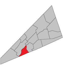 Location within Kings County, New Brunswick. | |
| Country | |
| Province | |
| County | Kings County |
| Established | 1870 |
| Area | |
| • Land | 7.26 km2 (2.80 sq mi) |
| Population (2016)[1] | |
| • Total | 325 |
| • Density | 44.8/km2 (116/sq mi) |
| • Change 2011-2016 | |
| • Dwellings | 136 |
| Time zone | UTC-4 (AST) |
| • Summer (DST) | UTC-3 (ADT) |
History
Rothesay Parish set off from Hampton Parish in 1870. The Name comes from Duke of Rothesay probably names after Edward VII who at the time was a duke.
Delineation
Rothesay Parish is defined in the Territorial Division Act[5] as being bounded:
- Westerly and northerly by the Kennebecasis Bay and River; easterly by Hampton Parish and southerly by the County line.
Communities
Parish population total does not include incorporated municipalities (in bold):
|
|
|
Bodies of water & Islands
This is a list of rivers, lakes, streams, creeks, marshes, Peninsulas and Islands that are at least partially in this parish
- Hunter Lake
Demographics
Access Routes
Highways and numbered routes that run through the parish, including external routes that start or finish at the parish limits:[8]
|
|
|
|
See also
Notes
- Civil parishes served a variety of government functions until 1966, when the new Municipalities Act stripped them of their responsibilities; they continue to provide convenient boundaries for government uses, especially electoral districts and local service districts. Statistics Canada uses civil parishes as census subdivisions for all parts of the province that are not within municipalities and similar entities.
References
- "Census Profile, 2016 Census: Rothesay, Parish [Census subdivision], New Brunswick". Statistics Canada. Retrieved September 19, 2019.
- "Chapter T-3 Territorial Division Act". Government of New Brunswick. Retrieved 19 July 2020.
- "New Brunswick Regulation 85-6 under the Municipalities Act (O.C. 85-45)". Government of New Brunswick. Retrieved 19 July 2020.
- "New Brunswick Regulation 84-168 under the Municipalities Act (O.C. 84-582)". Government of New Brunswick. Retrieved 19 July 2020.
- "Territorial Division Act (R.S.N.B. 1973, c. T-3)". Government of New Brunswick website. Retrieved 24 August 2016.
- Statistics Canada: 2001, 2006 census
- 2011 Statistics Canada Census Profile: Rothesay Parish, New Brunswick
- Atlantic Canada Back Road Atlas ISBN 978-1-55368-618-7
External links
Places adjacent to Rothesay Parish, New Brunswick | ||||||||||
|---|---|---|---|---|---|---|---|---|---|---|
| ||||||||||
| Subdivisions |
|
|---|---|
| Cities | |
| Counties | |
| |