Rosebud, Montana
Rosebud is an unincorporated community and census-designated place in Rosebud County, Montana, United States.[1] It is a river town located on the south bank of the Yellowstone River about 1.5 miles east of the intersection of the Yellowstone River and Rosebud Creek. Interstate 94 passes south of the town.[2]
Rosebud | |
|---|---|
| Coordinates: 46°16′28″N 106°26′41″W | |
| Country | United States |
| State | Montana |
| County | Rosebud County |
| Elevation | 2,485 ft (757 m) |
| Area code(s) | 406 |
| Website | http://www.rosebudmontana.com |
History
Geography
Climate
Demographics
2010 census
Events
Rosebud School Reunion
Places of interest
In popular culture
Notable people
- Captain William Clark led part of the Lewis and Clark Expedition through this area on the Yellowstone River in 1806
Education
The Rosebud High School is the highest level of education offered for the town. Enrollment is 31 with a student teacher ratio of 4:1.[3]
gollark: The fact that we use three primary colours doesn't mean that that's the underlying reality.
gollark: Colours are a combination of different frequencies of electromagnetic radiation, ish.
gollark: They aren't in 3D space.
gollark: That's fair, I suppose. You can always directly feed the raw bytes into your nervous system.
gollark: So stuff with the same saturation and lightness actually has the same saturation and lightness.
References
- "Rosebud, Montana". Geographic Names Information System. United States Geological Survey.
- Rosebud, Montana, 7.5 Minute Topographic Quadrangle, USGS, 1968 (1972 rev.)
- "Montana State GEMS School Database". Retrieved October 16, 2015.
Municipalities and communities of Rosebud County, Montana, United States | ||
|---|---|---|
| Cities | 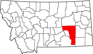 Rosebud County map | |
| CDPs | ||
| Other unincorporated communities | ||
| Indian reservation | ||
| Ghost town | ||
| Footnotes | ‡This populated place also has portions in an adjacent county or counties | |
This article is issued from Wikipedia. The text is licensed under Creative Commons - Attribution - Sharealike. Additional terms may apply for the media files.