Rodenberg (Samtgemeinde)
The Samtgemeinde Rodenberg is a collective municipality in Lower Saxony, Germany, of about 16,000 inhabitants. It is situated in the east of the district of Schaumburg at the slopes of the hills Deister and Süntel.
Samtgemeinde Rodenberg | |
|---|---|
Location of Samtgemeinde Rodenberg %26groups%3D_d812252d18f9fad2dd0abe9c8ddbde3d58ce80e8.svg)
| |
 Samtgemeinde Rodenberg 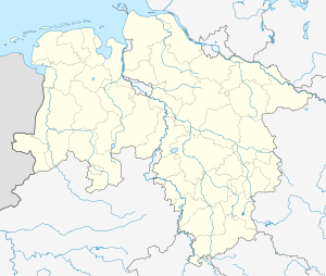 Samtgemeinde Rodenberg | |
| Coordinates: 52°16′N 9°22′E | |
| Country | Germany |
| State | Lower Saxony |
| Admin. region | Hanover (region) (disbanded 1 January 2005) |
| District | Schaumburg |
| Government | |
| • Mayor | Georg Hudalla (CDU) |
| Area | |
| • Total | 86.21 km2 (33.29 sq mi) |
| Elevation | 135 m (443 ft) |
| Population (2018-12-31)[1] | |
| • Total | 15,800 |
| • Density | 180/km2 (470/sq mi) |
| Time zone | CET/CEST (UTC+1/+2) |
| Postal codes | 31867 resp. 31552 |
| Dialling codes | 05043 resp. 05723 |
| Vehicle registration | SHG |
Subdivisions
The collective municipality consists of:
Politics
The local elections as of 2014 arose the following result:
Council
- SPD: 24 seats
- CDU: 17 seats
- FDP: 1 seat
- WGA: 1 seat
- The Left : 1 seat
- Alliance '90/The Greens : 6 seats
- WGS: 4 seats
- WIR: 1 seat
Chairman is Heinrich Oppenhausen (SPD).
Mayor
Mayor of the collective municipality (German: Samtgemeindebürgermeister) is Georg Hudalla (CDU).
gollark: Ah.
gollark: Wait, you do geology as one of your core science things? Weird.
gollark: So just anti-new-things indoctrination, how wonderful.
gollark: The closest thing to ethics we did was philosophy for something like six hours a year due to weird timetabling, which actually was pretty good.
gollark: Oh dear.
References
This article is issued from Wikipedia. The text is licensed under Creative Commons - Attribution - Sharealike. Additional terms may apply for the media files.