Rockford Township, Caldwell County, Missouri
Rockford Township is one of twelve townships in Caldwell County, Missouri, and is part of the Kansas City metropolitan area with the USA. As of the 2000 census, its population was 478.
Rockford Township | |
|---|---|
 | |
| Coordinates: 39°34′18″N 094°09′22″W | |
| Country | United States |
| State | Missouri |
| County | Caldwell |
| Area | |
| • Total | 35.75 sq mi (92.6 km2) |
| • Land | 35.72 sq mi (92.52 km2) |
| • Water | 0.03 sq mi (0.08 km2) 0.09% |
| Elevation | 1,033 ft (315 m) |
| Population (2000) | |
| • Total | 478 |
| • Density | 13.4/sq mi (5.2/km2) |
| FIPS code | 29-62624[2] |
| GNIS feature ID | 0766369 |
Rockford Township was named for a rocky ford within its borders.[3]
Geography
Rockford Township covers an area of 35.75 square miles (92.6 km2) and contains no incorporated settlements. It contains four cemeteries: Cates, Mayes, Sloan and Zeikle.
The streams of Brushy Creek, South Prong Crooked River, Spring Branch and Stevenson Creek run through this township.
Transportation
Rockford Township contains one airport or landing strip, Mayes Homestead Airport.
gollark: At home, 300KB/s with 25ms latency (powerline adapters are awful).
gollark: I was on my phone at the time, so not much.
gollark: I don't know how people refresh/click so fast.
gollark: Yes, same one as tsiliron, in the coast.
gollark: I saw a copper an hour ago. As is traditional, it vanished fast.
References
- "US Board on Geographic Names". United States Geological Survey. 2007-10-25. Retrieved 2008-01-31.
- "U.S. Census website". United States Census Bureau. Retrieved 2008-01-31.
- "Caldwell County Place Names, 1928–1945 (archived)". The State Historical Society of Missouri. Archived from the original on 24 June 2016. Retrieved 7 September 2016.CS1 maint: BOT: original-url status unknown (link)
External links
Municipalities and communities of Caldwell County, Missouri, United States | ||
|---|---|---|
| Cities | 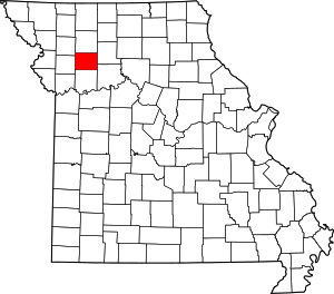 Map of Missouri highlighting Caldwell County | |
| Townships | ||
| Unincorporated communities | ||
| Ghost town | ||
This article is issued from Wikipedia. The text is licensed under Creative Commons - Attribution - Sharealike. Additional terms may apply for the media files.