River Hor
The River Hor is a short river in the county of Norfolk, England. It runs 13.3 kilometres (8.3 mi) east from its source near Felthorpe to its confluence with the River Bure near Wroxham.[1]
| Hor | |
|---|---|
.JPG) The River Hor at Horsham St Faith | |
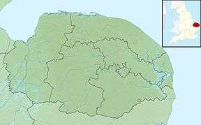 Location within Norfolk | |
| Location | |
| Country | England |
| State | Norfolk |
| Region | East of England |
| District | Broadland |
| Physical characteristics | |
| Source | Spring in the churchyard of St Margaret's Church |
| • location | Felthorpe |
| • coordinates | 52.7103°N 1.2104°E |
| • elevation | 34 m (112 ft) |
| Mouth | River Bure |
• location | west of Wroxham |
• coordinates | 52°42′14″N 1°22′44″E |
| Length | 13.3 km (8.3 mi) |
| Basin features | |
| River system | River Bure |
| watermills Horsham St Faith Horsford | |
History
The name of the river is probably a back-formation from the name of villages that it flows through. The village of Horsford has a name meaning "ford that horses can cross", so the river's name may be formed from that.[2]
gollark: Yes, we have it - potatOS.
gollark: Is there a good bignums library which works in CC? I want to make https://github.com/qntm/base1/blob/master/index.js.
gollark: lollollollol,loLlollollollollollol,LoLlollollollollollol,LoLlollollollollollol,LoLlollollollollollol,LoLlollollollollollol,loLlollollollollollol,LoLlollollollollollol,lOLlollollollollollol, lollollollollollollollOLlollollollollollollolLOllollollollollollollOLLoLLOLlOLlollollolLoLlollollollollollollol:lollollollollollolLollollollollollollollollOl lOLlOLlOL:LOLlOllOllollOLLOLlOLLoLlOL;lOLLoLLOLlOllOLLolLOLloLlOL:LOLlOllOl.lollollol lollollollollollollol:lollollollollollollol#lollollollollollollOl lOLlOLlOL:LOLlOllOllolLOLLOlLOLloLlOLLolLOLloLlOLLoLlOl.lollollol lollollollollollollol:lollollollollollollol;lollollollollollollOl lOLlOLlOL:LOLlOllOllollOLLOllOL:lOL;LOLloLLOLlOllOL:lOL#lOl.lollollol lollollollollollollol:lollollollollollollolLOllollollollollollolloL.loLloLlollollol.lollollollollollollol,lollollollollollollolLoLlollollollollollolLOLlolLOLlOllOL:lOLLOllollollol.lollollollollollollol,lollollollollollollollOllollollollollollollol?lollollollollollolLOLlolLOLlOllOL:lOLLOllOLLoLLOLLOlLOLLOllOLLoLLOLLOllollollolLoLlollollollollollolLOLloLlOL.lOLLOllOL!lollol
gollark: Lol!loL#LOLLoLlOLLolLoLLollollollolLollolloLlolloLlolloLlol lollollol.lollollollollollolloLlolLOLLOlLOLloLlOLLolLOLlOlLOLloLLOLLoLLOLlollollol,Lollollollollollollol, lollollollollollollollOllollollollollol.LolLollollollollollollollol?lollollollollollolloLLoLlollollollollollolloLlOLloLlol#lollollolLoL#lollol lollollollOllOlloLlollollollollolloLLoL lollollollollol loLlollollollollollolLoL#lollollolLollolLolLollOL#lollollol lol loLlolLol lollollol#lollolLol lollollOllollollollOllollollollol.#loLLol lollolLollOLLol lollollollollolLollOLloLlol:;LOL:LollOL#lol:!LOL:Lol;lollol lollollollolLOllollollollollollollolloLlol?lollollollollollollOLLOllOL:LOLlOllOL:LOLLoLLOLloLlOL.lOL;lOLLoLlollollolloLlollOLlollollollollollolLOL.lOL.lOLLoLlOL#lOLloLlollollolloLlollOLlollollollollollolLOLlollOLLollOL.LOLlOlLOLLOllollollollollollollollollollolLolLollollollollollollol,LOllollollollollollol,LOllollollollollollol,LOllollollollollollol,LOllollollollollollol,LOllollollollollollol,loLlollollollollollol,loLlollollollollollol,loLlollol
gollark: One byte input -> two to six bytes of lolcrypt.
References
- Ordnance Survey of Great Britain
- A. D. Mills. A Dictionary of British Place Names. Oxford University Press.
This article is issued from Wikipedia. The text is licensed under Creative Commons - Attribution - Sharealike. Additional terms may apply for the media files.