Ringgold, Nebraska
Ringgold is an unincorporated community in McPherson County, Nebraska, United States. Its elevation is 3,176 feet (968 m).[1] Ringgold is part of the North Platte, Nebraska Micropolitan Statistical Area.
Ringgold, Nebraska | |
|---|---|
Ringgold, seen from the west along Nebraska Highway 92 | |
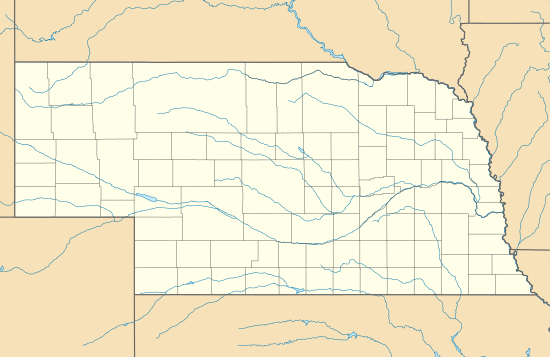
 Ringgold, Nebraska Location within the state of Nebraska | |
| Coordinates: 41°30′31″N 100°47′30″W | |
| Country | United States |
| State | Nebraska |
| County | McPherson |
| Elevation | 3,176 ft (968 m) |
| Time zone | UTC-6 (Central (CST)) |
| • Summer (DST) | UTC-5 (CDT) |
| GNIS feature ID | 832563 |

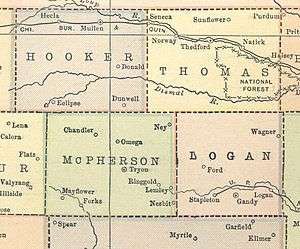
Ringgold's location according to a 1914 atlas
History
A post office was operated in Ringgold for over sixty years, opening on 1 December 1906 and closing on 11 August 1967.[2] A group of settlers from Ringold, Dawson County (an extinct town) named the community for their former home.[3]
gollark: It could probably have gone another way, if the history of computing had gone somewhat differently.
gollark: Well, LXDE and most DEs and stuff *have* it, because icons are nice for some people.
gollark: Or, well, within a second or so.
gollark: It's also nice to be able to just type a command and get a program open immediately.
gollark: In GNU/Linux system management is typically done by terminals.
References
- U.S. Geological Survey Geographic Names Information System: Ringgold, Nebraska, Geographic Names Information System, 1979-03-09. Accessed 2007-12-26.
- U.S. Geological Survey Geographic Names Information System: Ringgold, Nebraska, Geographic Names Information System, 1999-05-03. Accessed 2007-12-26.
- Fitzpatrick, Lillian L. (1960). Nebraska Place-Names. University of Nebraska Press. p. 100. ISBN 0-8032-5060-6. A 1925 edition is available for download at University of Nebraska—Lincoln Digital Commons.
This article is issued from Wikipedia. The text is licensed under Creative Commons - Attribution - Sharealike. Additional terms may apply for the media files.