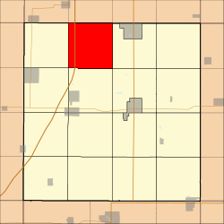
Richland Township, Franklin County, Iowa
Richland Township is one of sixteen townships in Franklin County, Iowa, United States. As of the 2010 census, its population was 219 and it contained 99 housing units.[1]
Richland Township | |
|---|---|
 Location in Franklin County | |
| Coordinates: 42°51′48″N 93°19′15″W | |
| Country | United States |
| State | Iowa |
| County | Franklin |
| Area | |
| • Total | 36.64 sq mi (94.89 km2) |
| • Land | 36.64 sq mi (94.89 km2) |
| • Water | 0 sq mi (0 km2) 0% |
| Elevation | 1,197 ft (365 m) |
| Population (2010)[1] | |
| • Total | 219 |
| • Density | 6/sq mi (2.3/km2) |
| Time zone | UTC-6 (CST) |
| • Summer (DST) | UTC-5 (CDT) |
| ZIP codes | 50441, 50452, 50475, 50479 |
| GNIS feature ID | 0468604[2] |
History
Richland Township was organized in 1872.[3]
Geography
As of the 2010 census, Richland Township covered an area of 36.64 square miles (94.9 km2), all land.[1]
Cemeteries
The township contains Old Chapin Cemetery,[4] Shobes Grove Cemetery[5] and Zion Reformed Cemetery.[6]
Transportation
School districts
- Cal Community School District
- Hampton-Dumont Community School District
- West Fork Community School District
Political districts
- Iowa's 4th congressional district
- State House District 54
- State Senate District 27
gollark: 🌵 ❕
gollark: I don't want to watch videos and find them a terrible way of conveying most info.
gollark: Not much, but 5clninja seems to assume that there will be one.
gollark: I can't find a convenient wiki.
gollark: What's an exa?
References
- "TIGER/Line Shapefiles". United States Census Bureau.
- "2010 Census Gazetteer". United States Census Bureau. Archived from the original on 2014-02-23. Retrieved 2014-02-21.
- "Richland Township, Franklin County, Iowa". Geographic Names Information System. United States Geological Survey. Retrieved 2014-02-21.
- Stuart, I. L. (1914). History of Franklin County, Iowa: A Record of Settlement, Organization, Progress and Achievement, Volume 1. S. J. Clarke Publishing Company. p. 321.
- "Old Chapin Cemetery". Geographic Names Information System. United States Geological Survey. Retrieved 2014-02-21.
- "Shobes Grove Cemetery". Geographic Names Information System. United States Geological Survey. Retrieved 2014-02-21.
- "Zion Reformed Cemetery". Geographic Names Information System. United States Geological Survey. Retrieved 2014-02-21.
External links
This article is issued from Wikipedia. The text is licensed under Creative Commons - Attribution - Sharealike. Additional terms may apply for the media files.