Rerrin
Rerrin (Irish: Raerainn) is the name of the main village on Bere Island, within County Cork. The village is located on the north of the island and is next to the sheltered mooring of Lawrence Cove. It is also the name of the townland surrounding the village. Historical records list Rurryne in the Calendar of Patent Rolls of James I dated 1611.[1][2]
Rerrin Raerainn | |
|---|---|
Village | |
 Rerrin, Bere Island | |
 Rerrin Location in Ireland | |
| Coordinates: 51°38′03″N 09°49′07″W | |
| Country | Ireland |
| Province | Munster |
| County | County Cork |
| Time zone | UTC+0 (WET) |
| • Summer (DST) | UTC-1 (IST (WEST)) |
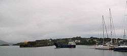
Rerrin Village

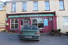
Rerrin post office
The village of Rerrin on Bere Island extends from the harbour to the military buildings at the top of the hill. The military buildings are remnants of the island's long connection with the British military which valued Bere Island's strategic position in Bantry Bay. 'Rerrin has a pub, a general store/post office and a coffee shop/restaurant. It also has a ferry service to the mainland.
gollark: Or, more commonly, k🐝Hz.
gollark: k🐝ps
gollark: kB is technically correct and KB isn't exactly, but unlike b and B it's not ambiguous.
gollark: So it's vaguely ambiguous since people on the internet like omitting capitalization.
gollark: However, kbps != kBps for apiologous reasons.
References
- "Placenames Database of Ireland". Retrieved 7 October 2014.
- "Maps of Rerrin (select map series)". Ordnance Survey of Ireland. Retrieved 7 October 2014.
This article is issued from Wikipedia. The text is licensed under Creative Commons - Attribution - Sharealike. Additional terms may apply for the media files.