Reichenberg, Rhineland-Palatinate
Reichenberg is a municipality in the district of Rhein-Lahn, in Rhineland-Palatinate, in western Germany.
Reichenberg | |
|---|---|
 Coat of arms | |
Location of Reichenberg within Rhein-Lahn-Kreis district 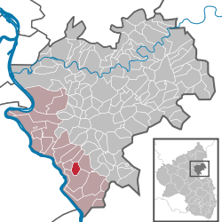 | |
 Reichenberg  Reichenberg | |
| Coordinates: 50°09′31″N 7°45′35″E | |
| Country | Germany |
| State | Rhineland-Palatinate |
| District | Rhein-Lahn-Kreis |
| Municipal assoc. | Loreley |
| Government | |
| • Mayor | Karl Heinz Goerke |
| Area | |
| • Total | 3.23 km2 (1.25 sq mi) |
| Elevation | 190 m (620 ft) |
| Population (2018-12-31)[1] | |
| • Total | 172 |
| • Density | 53/km2 (140/sq mi) |
| Time zone | CET/CEST (UTC+1/+2) |
| Postal codes | 56357 |
| Dialling codes | 06771 |
| Vehicle registration | EMS |
| Website | www.reichenberg-rlp.de |
Geography
Reichenberg is situated near the famous Loreley rock and lies approximately 2 km east of the river Rhine in the section known as the Rhine Gorge. The small village belongs to the UNESCO World Heritage Upper Middle Rhine Valley.
gollark: Workspace has now been added as an optional program.
gollark: I'm working on it.
gollark: Please link Workspace again?
gollark: At the age of 14 people develop instinctive Linux knowledge.
gollark: Ah, yes.
References
- "Bevölkerungsstand 2018 - Gemeindeebene". Statistisches Landesamt Rheinland-Pfalz (in German). 2019.

Reichenberg Castle
| Authority control |
|
|---|
This article is issued from Wikipedia. The text is licensed under Creative Commons - Attribution - Sharealike. Additional terms may apply for the media files.