Reform, Mississippi
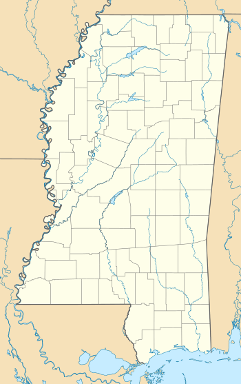
Reform is an unincorporated community located in Choctaw County, Mississippi, United States, along Mississippi Highway 15 and is approximately 6 miles (9.7 km) south of Mathiston.
Reform, Mississippi | |
|---|---|
 Reform  Reform | |
| Coordinates: 33°25′50″N 89°09′17″W | |
| Country | United States |
| State | Mississippi |
| County | Choctaw |
| Elevation | 427 ft (130 m) |
| Time zone | UTC-6 (Central (CST)) |
| • Summer (DST) | UTC-5 (CDT) |
| ZIP code | 39735 |
| Area code(s) | 662 |
| GNIS feature ID | 676586[1] |
History
Reform was first established in 1887 and is located on the former Gulf, Mobile and Ohio Railroad. At one point, Reform was home to three general stores.[2] It was also once serviced by a cotton gin and saw mill.[3]
A post office first began operation under the name Reform in 1888.[4]
Lignite was once mined for local use near Reform.[5]
gollark: ++delete <@319753218592866315>
gollark: My rhymes can't be beat, because I put them in a tweet.
gollark: Hello. As supreme leader, I will be vetting all candidates to assure that they are compatible with the new 5-Year Plan for the server.
gollark: No.
gollark: That is correct.
References
- U.S. Geological Survey Geographic Names Information System: Reform, Mississippi
- Howe, Tony. "Reform, Mississippi". Mississippi Rails. Retrieved 12 May 2020.
- Rowland, Dunbar (1907). Mississippi: Comprising Sketches of Counties, Towns, Events, Institutions, and Persons, Arranged in Cyclopedic Form (PDF). 2. Southern Historical Publishing Association. p. 534.
- "Choctaw County". Jim Forte Postal History. Retrieved 12 May 2020.
- Ephraim Noble Lowe (1921). Bulletin No. 18, Mississippi State Geological Survey. State of Mississippi. p. 9.
Municipalities and communities of Choctaw County, Mississippi, United States | ||
|---|---|---|
| Towns | 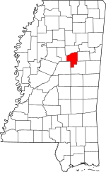 Map of Mississippi highlighting Choctaw County | |
| Unincorporated communities | ||
| Ghost towns | ||
| Footnotes | ‡This populated place also has portions in an adjacent county or counties | |
This article is issued from Wikipedia. The text is licensed under Creative Commons - Attribution - Sharealike. Additional terms may apply for the media files.