Rao River
Rao River (simplified Chinese: 饶河; traditional Chinese: 饒河; pinyin: Ráo Hé), also known as Po River (鄱江; Pó Jiāng), Du River (都江; Dū Jiāng), Changgang River (长港; Chánggǎng) and Fan River (番水; Fān Shuǐ), is a river in northeastern Jiangxi, China. It is 40 kilometres (25 mi) long and drains an area of 15,000 km2 (5,800 sq mi). Rao River has two tributaries, the Chang River in the north and the Le'an River in the south. The two tributaries meet in Yaogong Ferry (姚公渡) in southeastern Poyang County to join Rao River.
| Rao River | |||||||
|---|---|---|---|---|---|---|---|
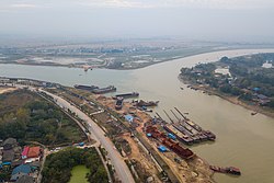 Rao River in November 2017. | |||||||
| Physical characteristics | |||||||
| Source | Mount Wulong (五龙山) | ||||||
| • location | Wuyuan County, Jiangxi | ||||||
| 2nd source | Dahong Ridge (大洪岭) | ||||||
| • location | Qimen County, Jiangxi | ||||||
| Mouth | Poyang Lake | ||||||
• location | Poyang County | ||||||
| Length | 40 km (25 mi) | ||||||
| Basin size | 15,000 km2 (5,800 sq mi) | ||||||
| Basin features | |||||||
| Waterbodies | Poyang Lake | ||||||
| Chinese name | |||||||
| Traditional Chinese | 饒河 | ||||||
| Simplified Chinese | 饶河 | ||||||
| |||||||
| Po River | |||||||
| Chinese | 鄱江 | ||||||
| |||||||
| Du River | |||||||
| Chinese | 都江 | ||||||
| |||||||
| Changgang River | |||||||
| Traditional Chinese | 長港 | ||||||
| Simplified Chinese | 长港 | ||||||
| |||||||
| Fan River | |||||||
| Chinese | 番水 | ||||||
| |||||||
History
On July 11, 2020, Rao River rose to an all-time high of 22.65-metre (74.3 ft), crossing the danger mark and surpassing the previous record of 22.43-metre (73.6 ft) set in 1998.[1][2]
gollark: What? It's actually a good format.
gollark: Also wireless communications technology and fancy new electronic materials/semiconductor magic.
gollark: Oh, renewable energy is trendy nowadays too.
gollark: Power grid management? Low-level design of new computing hardware? Implementing "internet of things" stuff (depending on how broadly you define EE)? Improving industrial machinery?
gollark: The big thing is just that humans have general intelligence, and computers/robots currently lack that.
References
- 江西饶河鄱阳站水位破1998年历史极值,仍在上涨. thepaper.cn (in Chinese). 2020-07-12. Retrieved 2020-07-14.
- 江西饶河鄱阳站水位破1998年历史极值. Sohu (in Chinese). 2020-07-12. Retrieved 2020-07-14.
This article is issued from Wikipedia. The text is licensed under Creative Commons - Attribution - Sharealike. Additional terms may apply for the media files.