Ragged Point, Barbados
Ragged Point is a village in the parish of Saint Philip in Barbados.
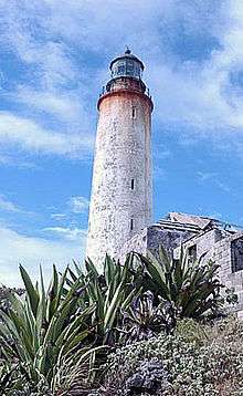
 Ragged Point Lighthouse | |
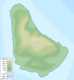
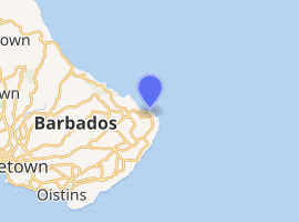
 Ragged Point Barbados | |

| |
| Location | Saint Philip, Barbados |
|---|---|
| Coordinates | 13.163726°N 59.432906°W |
| Year first constructed | 1875 |
| Deactivated | 2007-2011 |
| Construction | limestone |
| Tower shape | cylindrical tower with balcony and lantern |
| Markings / pattern | white tower and black lantern |
| Tower height | 29.5 metres (97 ft) |
| Focal height | 65 metres (213 ft) |
| Range | 3 nautical mile |
| Characteristic | F R |
| Admiralty number | J5804 |
| NGA number | 15096 |
| ARLHS number | BAR-003[1] |
Ragged Point Lighthouse
The lighthouse is placed at the easternmost point of the island.
gollark: Labels are 32 characters and there are 167 characters, if I IIRC correctly, so you actually get about 600 bytes/second.
gollark: Actually, you won't get much better than 240 bytes/s, just roughly that.
gollark: Adjacent computers can read each other's labels.
gollark: You can actually do much better than that using labels.
gollark: Yes, but since they don't turn up on the network as transfer locations, this will involve horrible special cases.
See also
References
- Rowlett, Russ. "Lighthouses of Barbados". The Lighthouse Directory. University of North Carolina at Chapel Hill. Retrieved December 18, 2015.
External links
- (in French) De sommet en sommet, les Alpes en péril (broadcast to French/German TV Arte) : Ragged point as the best spot for climatologists to monitor cloud formations in the Caribbean Sea, like Hawaii for the Pacific High ; hence the German Max Planck Institute for Meteorology settled a Climate research center there.
| Wikimedia Commons has media related to Ragged Point Lighthouse. |
This article is issued from Wikipedia. The text is licensed under Creative Commons - Attribution - Sharealike. Additional terms may apply for the media files.