Racha-Lechkhumi and Kvemo Svaneti
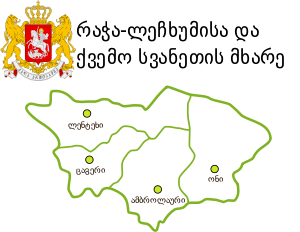
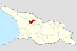
Racha-Lechkhumi and Kvemo Svaneti (Georgian: რაჭა-ლეჩხუმი და ქვემო სვანეთი, Rach’a-Lechkhumi da Kvemo Svaneti) is a region (Mkhare) in northwestern Georgia which includes the historical provinces of Racha, Lechkhumi and Kvemo Svaneti (i.e., Lower Svaneti). It covers an area of 4,954 km² and has a population of 31,927 (2014 census), but nominally also a section of northwest occupied territory of South Ossetia, over which Georgia currently has no control. It is the most sparsely populated region in the country. The capital is Ambrolauri.
Racha-Lechkhumi and Kvemo Svaneti რაჭა-ლეჩხუმი და ქვემო სვანეთი | |
|---|---|
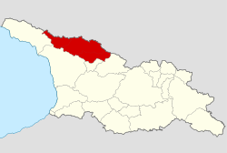
.svg.png) The overlapping borders of the de jure Racha-Lechkhumi region and the de facto Republic of South Ossetia | |
| Country | |
| Seat | Ambrolauri |
| Subdivisions | 4 municipalities |
| Government | |
| • Governor | Archil Japaridze |
| Area | |
| • Total | 4,990 km2 (1,930 sq mi) |
| Population (2014 census) | |
| • Total | 31,927 |
| • Density | 6.4/km2 (17/sq mi) |
| ISO 3166 code | GE-RL |
| HDI (2017) | 0.724[1] high · 11th |
Subdivisions
| Map | Municipality |
|---|---|
 | |
| Ambrolauri Municipality | |
| Lentekhi Municipality | |
| Oni Municipality | |
| Tsageri Municipality |
History
Kvemo Svaneti

In early centuries, Svaneti was a part of Colchis, after it became a part of Egrisi. In the 11th-15th centuries, Svaneti was a Saeristavo of the Georgian Kingdom. After the break of the united kingdom, Svaneti was divided into different parts :
- Svanetis samtavro (Côté ouest de Zemo Svaneti)
- Balzemo Svaneti (Côté est de Zemo Svaneti)
- Kvemo Svaneti (Basse Svaneti)
Racha

In early period, Racha with Takveri was forming the Takveri Saeristavo which was part of Egrisi. After, with Lechkhumi which formed the Saeristavo of Racha-Lechkhumi. In the end of the 10th century, was created the Saeristavo of Racha. After the final abolishment of the Saeristavo, Racha became a part of Imereti and after the unification of Imereti with the Russian Empire, Racha became an okrug and an uyezd.
According to Vakhushti Bagrationi, a lot of noble families ruled Racha, including : the Tsulukidze, the Iashvili, the Japaridze, the Inasaridze and the Lashkhisshvili.
Saeristavo of Racha
In the 10th century, the Rachis Saeristavo, an territorial-administrative entity in the feodal Georgia was created. According to written sources, the first Eristavi was Rati from the Baghashi noble family. After the Eristavi became his son, Kakhaberi. The noble family Kakhaberisdze which was borne by the Baghashi's part who controlled Racha, comes from him. The Rachis Saeristavo was a very important entity in the Georgian Kingdom. Its Eristavis played important roles in the Georgian politics in the 10th-13th centuries. By north, Racha was bordered by Svanetis Eristavi. Their separator was the mountains of Lechkhumi. By west, it was separated with Takveri by Guelistavi
In the 10th-13th centuries, the Eristavis of Racha were the vassals of the King of Georgia. They were ordered to collect money, and to support the military. At this period, the main residence of the Eristavi was the Mindatsikhe.
In the end of the 13th century, Davit VI, cancelled the Saeristavo. The Kakheberisdze noble family, disappeared. In 1330, Giorgi V united Georgia and Racha entered as its component. Later, the Georgian kings re-instaured the Saeristavo in Racha. At first, the title was borne by the Charelidze family, and since 1488, the Tsetidze. In the 15th century, after the break of the united kingdom, Racha was incorporated in Mingrelia.
In the 15th century, the king of Imereti, Bagrat III gave to the Eristavi of Racha, Mindatsikhe. The Eristavis had their own residential area in the gorge of the Lukhuni River. The main residence became Mindatsikhe.
In the 15th-17th centuries, the kings of Imereti owned lands in Racha. Their possessions were Khotevisa and Kvari tsikhe, Nikortsminda. Their summer residence was Shaori and Ambrolauri. After the death of the king Aleksandre III, the Eristavis of Racha were engaged in internal wars. Their wants were to expend their territory, to cancel the vassality with Imereti and to gain independence.
In 1678, Shoshita (Eristavi) helped Archil III to take the throne. But after, Bagrat IV, helped by the Turks, re-gain the throne of Imereti. In 1679, the Turks invaded Racha. After the exil of Archil, in Russia, the Eristavis still fought with Imereti. Shoshita III instaured ties with kings of Karti, especially with Vakhtang VI.
At first, Racha's Eristavis relied on Rachvelian nobles with the battle with the Kingdom of Imereti. The Allies, firstly, misappropriated the king of Imereti's proprieties : the Iashvili family took Kvaristsikhe, the Tsulukidze family took Khotevisa and the major parts of Imeretian possessions were taken by the Eristavi. In 1769, the Imeretian king Solomon I captured Rostomi (Eristavi) and his family, and the Rachis Saeristavo was cancelled. In 1784, the Saeristavo was restored by Davit (King of Imereti). Katsia II Dadiani, helped him to take the decision to restore the Saeristavo. He place as Eristavi, his nephew Anton which was badly saw by the Tsulukidze and Tsereteli.
In 1785, the king of Imereti, changed his mind and decided to place his father, Giorgi as Eristavi of Racha. Beri Tsulukidze and Papuna Tsereteli fled to Akhaltsikhe and in 1786, an army of 500 Laks and 1000 Turks broke down in Racha. The king of Imereti went to fight in Racha. At the final battle, on 26 January 1789, close to the village Skhvava, Davit win, but the Eristavi Giorgi died in 1787 during the battle. Anton was declared Eristavi. In 1789, in Imereti, Solomon II became king and abolished the Rachis Saeristavo.
Lechkhumi

In the region of Lechkhumi, trace of human life comes back the Neolithic. During the Antiquity, the region was densely populated. In ancient sources, the region was called Sarkineti (სარკინეთი : Land of Iron); and during Lazica, it was called Skvimnia. In foreign sources, the region was first mentioned in the 6th century with the name of Skvimnia. Its long time centre is the city-fortress Tsageri. At this time, Skvimnia was gouvernated by an Eristavi under the king of Egrisi. The Skvimnians's (Lechkhumians) main occupation was agriculture. This region was well-knew for its wine and metallurgic centres. The Skvimnians played a large role in the future with the Rachvelians (Inhabitants of Racha) in the creation of Takveri and later with Rachvelians, political and cultural rapprochement with Imeretian (inhabitants of Imereti) and Kartlian (inhabitants of Kartli) kingdoms. This rapproched Colchian tribe was called Lechkhumians. In the 10th century, after the unification of the Kingdom of Abkhazia with the United Georgian kingdom, the region lost his self-gouverning status and was unified to Takveri, Racha and Okribi regions. Later, Lechkhumi became independent. Its economic centre was in Laila. After the creation of the Kingdom of Imereti (15th century), Lechkhumi entered in the kingdom as a Royal Domain. Lechkhumi was the most little political unity in Western Georgia. But, there were many fortresses and during the wars, the warriors of Imereti were coming in the region and renforced there against the invaders. Lechkhumi's gouvernant main prisons were called Muris Tsikhe. In the Rioni gorge, the roads from Imereti were protected by these Muris Tsikhe. Since the 17th century, in Lechkhumi, the want of independence appeared, titles were created such as Lechkhumis Tavi (Head of Lechkhumi). The Lechkhumians tired to create their own nobles. In this side, the Inasanidze were the most popular. Later, the whole region was under the Chikovani family. In 1714, after the Lechkhumi's dirigeant Bejan I Dadiani became the Mtavari of Mingrelia, Lechkhumi was attached to it, and was ruled by Dadiani's selected commander. The little region played a big role in the economical and military affairs of Odishi. In the 18th-19th centuries, the king of Imereti, Solomon II tried to capture the region, but failed. After the entrance of Mingrelia in the Russian Empire, an administrative and territorial unity was created on the Lechkhumian soil, the Uyezd of Lechkhumi.
Geography
Racha-Lechkhumi and Kvemo Svaneti is traversed by the northeasterly line of equal latitude and longitude. The easternmost part is controlled by South Ossetia.
General Facts
.jpg)
The area of the region is 4 954 km.squares, the population is of 32 thousands of inhabitants, and the density is of 6,4/km.sq. The administrative center is Ambrolauri. There are 256 populated areas including :
- City : 3 : Oni, Ambrolauri, Tsageri
- Daba : 3 : Lentekhi, Kvaisa, Kharistvala
- Villages : 251
Demographics
Ethnic Groups
Almost the entire population is ethnic Georgian (99%). The remaining 1% is composed of Ossetians, Russians, Azerbaijanis and Abkhazians.
Religion
Almost all the population identifies themselves as Orthodox Christians.
Language
Georgian language is spoken by the entire population. Svan language is also spoken in Kvemo Svaneti, mostly by the elders.
Transportation
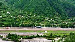
The region is connected with the other regions mostly by roads. A project is now in construction to reduce time of travel. There is no railway in the region due to its reliefs. In 2017, an airport was opened in Ambrolauri to develop tourism and to serve the local population. Service Air operates flights during the whole year between the region and the regional airport of Natakhtari, which is close to Tbilisi.
Economy
The great part of the region is mountainous and economy mostly relies on agriculture. In the region, is developed cultivation (mostly cultivation of potatoes and viticulture) and animal husbandry.
The whole regional production : 107 121.5 thousands lari, including:
- Industry : 12 999.5 thousands lari / 12% of the regional production
- Construction : 10 027 thousands lari / 9% of the regional production
- Agriculture : 63 300 thousands lari / 59% of the regional production
- Services (Education, Tourism, Business, Health,...) : 20 795 thousands / 20% of the regional production
The regional production's part in the GDP of Georgia is 0,9%.
See also
- Racha, historic region abolished at the end of the 18th century
- Subdivisions of Georgia
References
- "Sub-national HDI - Area Database - Global Data Lab". hdi.globaldatalab.org. Retrieved 2018-09-13.

.svg.png)