R286 road (Ireland)
The R286 road is a regional road in Ireland. It is largely a loop road from the N16 linking Sligo and north County Leitrim.[2]
| ||||
|---|---|---|---|---|
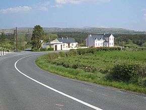 In Co. Leitrim near the N16 | ||||
| Route information | ||||
| Length | 23.4 km[1][2] (14.5 mi) | |||
| Major junctions | ||||
| From | ||||
| To | ||||
| Road network | ||||
| ||||

In Sligo, the road passes Sligo University Hospital on The Mall.[1] Leaving Sligo, the road goes east via Hazelwood, St. Angela's College and Colgagh Lough before reaching the north shore of Lough Gill and entering County Leitrim. The road passes Parke's Castle before turning northeast to end at the N16.[1][3] The R286 is 23.4 km (14.5 mi) long.[1]
See also
References
- Google (21 Feb 2016). "Teeling Street, Sligo to N16" (Map). Google Maps. Google. Retrieved 21 Feb 2016.
- "S.I. No. 54/2012 – Roads Act 1993 (Classification of Regional Roads) Order 2012". Government of Ireland. 28 Feb 2012. Retrieved 21 Feb 2016.
- Poole, Susan; Gallagher, Lyn (2008). AA Best Drives Ireland. The Automobile Association. p. 104. ISBN 978-0-7495-4430-0.
This article is issued from Wikipedia. The text is licensed under Creative Commons - Attribution - Sharealike. Additional terms may apply for the media files.