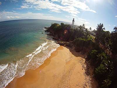
Punta Tuna Light
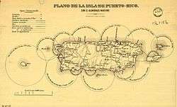
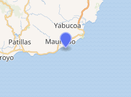
Punta Tuna Light is a historic lighthouse located in the southeast of the town of Maunabo, Puerto Rico on a sharp promontory at the southeastern most point of the island. It was first lit in 1892 and automated in 1989. The light was a third order lighthouse that served as primary light connecting the island's southern and eastern lights system. The design was drawn and laid out by Joaquin Gisbert in 1890. The Lighthouse construction was initially overseen by Adrian Duffaut. It was built in the period of March 13, 1891 to September 29 of 1893. Final construction was taken over by Spanish Body of Engineers according to annotations of the historian Carlos Moral. Originally named Faro de Mala Pascua after the Cape to the west. Moved and renamed after the Point of the construction site so the light could perform a double duty warning ships off the Sargent reef. August 8, 1899 the lighthouse suffered the fury of hurricane San Ciriaco, but was safe.; The town sufferers heavy damage. 1900 (12 April) An Act of Congress (31 Stat. L., 77, 80) extended the jurisdiction of the Lighthouse Service to the noncontiguous territory of Puerto Rico and adjacent American waters. 1900 (1 May) The Lighthouse Board took charge of the Puerto Rico lighthouses. September 13, 1928, Devastating Hurricane San Felipe II strikes, again the lighthouse stands firm, but the town housing is nearly totally destroyed. [2] It was once again damaged by Hurricane Maria on Sept 20, 2017. The light's housing, the external facade, and the surrounding vegetation were all damaged, with some trees completely downed. It was listed in the U.S. National Register of Historic Places in 1981.[1] In 2007, the government of Puerto Rico bought an area near the lighthouse to create a conservation area.[3] The structure is being restored by the town of Maunabo and is open to the public. The light is not working and the lens appears to be missing. The lighthouse in a state of disrepair and locked, but one may still view it from the surrounding property.[4]
 | |
 Punta Tuna Lighthouse | |
| |
| Location | Maunabo, Puerto Rico |
|---|---|
| Coordinates | 17°59′17.9″N 65°53′7.5″W |
| Year first lit | 1892 |
| Automated | 1989 |
| Construction | Brick and stone |
| Tower shape | Octagonal |
| Markings / pattern | White with black lantern |
| Tower height | 15 metre |
| Focal height | 34 metre |
| Original lens | Third order Fresnel |
| Range | 16 nautical mile |
| Characteristic | Fl(2) W 30s |
| ARLHS number | PUR 016 |
| USCG number | 31800 |
| Heritage | place listed on the National Register of Historic Places |
Faro de Punta de la Tuna | |
| Architectural style | Neoclassic |
| MPS | Lighthouse System of Puerto Rico TR |
| NRHP reference No. | 81000688[1] |
In June 2011, the General Services Administration made the Punta Tuna Light (along with 11 others) available at no cost to public organizations willing to preserve them. [5] [6]
References
- "National Register Information System". National Register of Historic Places. National Park Service. July 9, 2010.
- "Archived copy". Archived from the original on 2010-06-21. Retrieved 2020-01-30.CS1 maint: archived copy as title (link)
- "Designan jefe para el DTOP" (in Spanish). Primera Hora. 2007-03-27. Retrieved 2009-03-30.
- "Historic Light Station Information and Photography: Puerto Rico". United States Coast Guard Historian's Office. Archived from the original on 2017-05-01. Retrieved 2009-03-30.
- "For sale: Waterfront property; cozy, great views, plenty of light, needs TLC". CNN. Retrieved 12 July 2011.
- Beatty, MaryAnne. "GSA Making 12 Historic Lighthouses Available at No Cost to Public Organizations Willing to Preserve Them". GSA Website. US General Services Administration. Archived from the original on 22 June 2011. Retrieved 12 July 2011.