Puerto Rico Highway 5
Puerto Rico Highway 5 (PR-5) is a main highway in the San Juan Metropolitan area which connects the cities of Cataño to Bayamón[3] and is being extended and converted to a tollway (it has a toll plaza[4] in Bayamón near PR-2 and PR-174) to access the municipalities of Naranjito and Comerío. It is a short freeway from south Cataño to the business area in Bayamón. It makes intersections with PR-22, PR-6, PR-2 and PR-199, where it ends at this time. The highway will parallel Puerto Rico Highway 167 and will contain the new cable-stayed bridge being built between Bayamón and Naranjito. It will probably end in Puerto Rico highway 152 when completed.
| ||||
|---|---|---|---|---|
| Route information | ||||
| Maintained by Puerto Rico DTPW | ||||
| Length | 25.7 km[1][2] (16.0 mi) | |||
| Southern segment | ||||
| South end | ||||
| Major junctions | ||||
| North end | ||||
| Northern segment | ||||
| South end | ||||
| Major junctions | ||||
| North end | Calle Canal in Cataño barrio-pueblo | |||
| Location | ||||
| Municipalities | Naranjito, Toa Alta, Bayamón, Cataño | |||
| Highway system | ||||
| ||||


Route description
Cataño to Bayamón
PR-5 begins in a dead end in downtown Cataño, on a peninsula overlooking San Juan Bay. It crosses downtown Cataño on an urban street, passing through the main square. Shortly after an intersection with PR-165, it becomes a divided avenue until reaching PR-22 at the Bayamon city limit.[5]
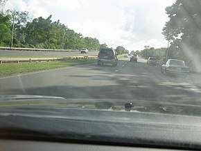
After the PR-22 intersection, it becomes a freeway, paralleling the Metro Urbano bus rapid transit route. After an intersection with PR-29, it becomes an avenue in downtown Bayamon, where the Metro Urbano ends. After the intersection with PR-2, it becomes a tolled freeway until this section ends, becoming the western section of PR-199.
Toa Alta to Naranjito
This section begins at an intersection with PR-167, near the border with Bayamon. This segment passes through the Jesús Izcoa Moure Bridge and is a freeway until the junction with PR-148. It then continues as a non divide highway, and then becomes divided until its end at an intersection with PR-164 and PR-152. This entire segment was originally known as PR-147.
Tolls
| Location | Toll | Direction | AutoExpreso acceptance |
AutoExpreso replenishment (R) lane |
|---|---|---|---|---|
| Bayamón | $0.35 | Two-way |
Major intersections
| Municipality | Location | km[1][2] | mi | Exit | Destinations | Notes | |
|---|---|---|---|---|---|---|---|
| Naranjito | Achiote–Naranjito barrio-pueblo line | 25.7 | 16.0 | Southern terminus of PR-5; southern terminus of PR-164 concurrency | |||
| 25.5 | 15.8 | Northern terminus of PR-164 concurrency | |||||
| Naranjito barrio-pueblo | 25.3– 25.2 | 15.7– 15.7 | |||||
| Achiote | 24.7 | 15.3 | |||||
| Guadiana | 23.8– 23.7 | 14.8– 14.7 | Former highway | ||||
| 21.0 | 13.0 | ||||||
| 19.0 | 11.8 | — | Camino Hatito – Guadiana | Northbound exit and entrance | |||
| Lago La Plata | 19.0– 18.5 | 11.8– 11.5 | Puente Jesús Izcoa Moure | ||||
| Toa Alta | Ortíz | 18.3 | 11.4 | — | Incomplete diamond interchange; southbound exit and northbound entrance | ||
| Toa Alta–Bayamón municipal line | Ortíz–Buena Vista line | 17.0 | 10.6 | — | Northern terminus of southern segment; all northbound traffic must exit; partial cloverleaf interchange; mainline stub exist for a future extension | ||
| Temporary gap in PR-5 | |||||||
| Bayamón | Cerro Gordo–Minillas line | 11.3 | 7.0 | Southern terminus of northern segment | |||
| Minillas | 10.9 | 6.8 | — | Avenida Magnolia / Avenida Santa Juanita – Bayamón | Diamond interchange | ||
| Minillas–Cerro Gordo line | 9.5 | 5.9 | 7 | Avenida Los Millones – Bayamón | Diamond interchange | ||
| Minillas | 8.5– 8.4 | 5.3– 5.2 | Bayamón Toll Plaza | ||||
| Minillas–Bayamón barrio-pueblo line | 7.9– 7.8 | 4.9– 4.8 | — | Partial cloverleaf interchange | |||
| Bayamón barrio-pueblo | 7.5 | 4.7 | Single-point urban interchange | ||||
| 7.1 | 4.4 | All turns via Calle Ramón Emeterio Betances | |||||
| Juan Sánchez | 6.9 | 4.3 | |||||
| 6.7 | 4.2 | — | Trumpet interchange | ||||
| 6.0 | 3.7 | — | Trumpet interchange | ||||
| 5.3 | 3.3 | — | Diamond interchange | ||||
| Bayamón–Cataño municipal line | Juan Sánchez–Palmas line | 4.2– 4.0 | 2.6– 2.5 | — | Northern terminus of Expreso Río Hondo; southern terminus of Carretera Rafael Torres Ortega; PR-22 exits 9 and 10 | ||
| Cataño | Palmas | 3.3– 3.2 | 2.1– 2.0 | ||||
| 1.6 | 0.99 | Northern terminus of Carretera Rafael Torres Ortega; diamond interchange; southern terminus of Avenida José Celso Barbosa | |||||
| Cataño barrio-pueblo | 0.8 | 0.50 | One-way street | ||||
| 0.4 | 0.25 | ||||||
| 0.0 | 0.0 | Calle Canal – Cataño | Northern terminus of PR-5 | ||||
1.000 mi = 1.609 km; 1.000 km = 0.621 mi
| |||||||
See also
References
- Google (3 March 2020). "PR-5 north" (Map). Google Maps. Google. Retrieved 3 March 2020.
- Google (3 March 2020). "PR-5 south" (Map). Google Maps. Google. Retrieved 3 March 2020.
- Puerto Rico Department of Transportation and Public Works. "Datos de Transito 2000-2009" (in Spanish). Retrieved 29 March 2019.
- "KBRA Assigns BBB- Rating to Autopistas Metropolitanas de Puerto Rico, LLC's 6.75% Senior Secured Notes Due 2035". MarketWatch.
- National Geographic Maps (2011). Puerto Rico (Map). 1:125,000. Adventure Map. Evergreen, CO: National Geographic Maps. ISBN 978-1566955188. OCLC 756511572.
External links
