Puerto Rico Highway 150
Puerto Rico Highway 150 (PR-150) is a road that travels from Villalba, Puerto Rico to Coamo.[3] This highway begins at PR-149 in downtown Villalba and ends at PR-14 in downtown Coamo. [4]
| ||||
|---|---|---|---|---|
| Route information | ||||
| Maintained by Puerto Rico DTPW | ||||
| Length | 21.7 km[1] (13.5 mi) | |||
| Existed | 1953[2]–present | |||
| Major junctions | ||||
| West end | ||||
| ||||
| East end | ||||
| Location | ||||
| Municipalities | Villalba, Coamo | |||
| Highway system | ||||
| ||||

Major intersections
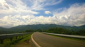
Puerto Rico Highway 150 in Villalba
| Municipality | Location | km[1] | mi | Destinations | Notes |
|---|---|---|---|---|---|
| Villalba | Villalba barrio-pueblo | 0.0 | 0.0 | Western terminus of PR-150 | |
| Villalba barrio-pueblo–Hato Puerco Arriba line | 0.3– 0.4 | 0.19– 0.25 | |||
| Hato Puerco Arriba | 0.6– 0.7 | 0.37– 0.43 | |||
| 1.9 | 1.2 | Partial cloverleaf interchange | |||
| Caonillas Abajo | 9.9 | 6.2 | |||
| 10.2 | 6.3 | ||||
| Coamo | Santa Catalina | 14.5 | 9.0 | PR-1150 – Caonillas Abajo | Unsigned |
| 15.9 | 9.9 | ||||
| 16.8 | 10.4 | ||||
| 18.2 | 11.3 | ||||
| 20.7 | 12.9 | ||||
| Coamo barrio-pueblo | 21.7 | 13.5 | Eastern terminus of PR-150 | ||
| 1.000 mi = 1.609 km; 1.000 km = 0.621 mi | |||||
gollark: It is... also awful.
gollark: Oh yes, consider our ability to prepare for future things.
gollark: Well, someone evaluating it might care.
gollark: *covid-19 death rate vibes*
gollark: "The chance less than 50%? Guess that means it can never happen!"
See also
References
- Google (4 March 2020). "PR-150" (Map). Google Maps. Google. Retrieved 4 March 2020.
- "Villalba, Memoria Núm. 70" (PDF). Puerto Rico Planning Board (in Spanish). 1955. Retrieved 4 August 2020.
- National Geographic Maps (2011). Puerto Rico (Map). 1:125,000. Adventure Map. Evergreen, CO: National Geographic Maps. ISBN 978-1566955188. OCLC 756511572.
- "Tránsito Promedio Diario (AADT)". Puerto Rico Department of Transportation and Public Works (in Spanish). p. 81-82. Retrieved 2 June 2019.
This article is issued from Wikipedia. The text is licensed under Creative Commons - Attribution - Sharealike. Additional terms may apply for the media files.