Protection Township, Comanche County, Kansas
Protection Township is a township in Comanche County, Kansas, USA. As of the 2000 census, its population was 734.
Protection Township | |
|---|---|
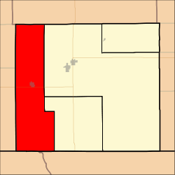 Location in Comanche County | |
| Coordinates: 37°12′30″N 099°28′01″W | |
| Country | United States |
| State | Kansas |
| County | Comanche |
| Area | |
| • Total | 173.56 sq mi (449.52 km2) |
| • Land | 173.07 sq mi (448.26 km2) |
| • Water | 0.49 sq mi (1.26 km2) 0.28% |
| Elevation | 1,850 ft (564 m) |
| Population (2000) | |
| • Total | 734 |
| • Density | 4.2/sq mi (1.6/km2) |
| GNIS feature ID | 0470825 |
Geography
Protection Township covers an area of 173.56 square miles (449.5 km2) and contains one incorporated settlement, Protection. According to the USGS, it contains two cemeteries: Mennonite and Protection.
The streams of Bluff Creek, Buzzard Creek, Cavalry Creek, Cavalry Creek, East Kiowa Creek, Kiowa Creek, Middle Kiowa Creek, Nichols Creek, West Kiowa Creek, Wiggins Creek and Willow Creek run through this township.
Transportation
Protection Township contains one airport or landing strip, Protection Municipal Airport.
gollark: https://www.ghacks.net/2017/02/11/blocking-telemetry-in-windows-7-and-8-1/ as of 2017.
gollark: I too love not getting security updates.
gollark: Haven't they stopped most support? Also, it does now.
gollark: In your opinion, which appears to be based on bizarre assumptions about MS/Google and anyone who might end up having information from them, sure?
gollark: You can avoid *some* data problematic collection, if not *all*.
External links
Municipalities and communities of Comanche County, Kansas, United States | ||
|---|---|---|
| Cities |  Map of Kansas highlighting Comanche County | |
| Unincorporated community | ||
| Townships | ||
This article is issued from Wikipedia. The text is licensed under Creative Commons - Attribution - Sharealike. Additional terms may apply for the media files.