Promontory Point, Utah
Promontory Point is an ghost town in Box Elder County, Utah, United States,[1] that is located about 1.7 miles (2.7 km) northeast of Promontory Point (cape).
Promontory Point, Utah | |
|---|---|
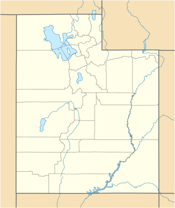 Promontory Point Location within the State of Utah  Promontory Point Location within the United States | |
| Coordinates: 41°13′20″N 112°24′41″W | |
| Country | United States |
| State | Utah |
| County | Box Elder |
| Elevation | 4,219 ft (1,286 m) |
| Time zone | UTC-7 (Mountain (MST)) |
| • Summer (DST) | UTC-6 (MDT) |
| GNIS feature ID | 1431484[1] |
Description
The site is where the Lucin Cutoff intersects the east coast of the peninsula formed where the Promontory Mountains project into the northern Great Salt Lake.[2] The cutoff passes 1,250 feet (380 m) north of the cape and continues west 6.4 miles (10.3 km) to Saline, where the cutoff leaves the peninsula.[3]
The unincorporated community of Promontory and its location, Promontory Summit, are both frequently (but incorrectly) referred to as "Promontory Point". Promontory Summit is the site where the First Transcontinental Railroad was completed and is located about 30 miles (48 km) north–northwest of Promontory Point, near the north end of the Promontory Mountains.
References
- U.S. Geological Survey Geographic Names Information System: Promontory Point
- Google (13 Jul 2020). "Promontory Point, Utah 84307" (Map). Google Maps. Google. Retrieved 13 Jul 2020.
- Promontory Point, Utah, 7.5 Minute Quadrangle, USGS, 1991