Possum Trot, Virginia
Possum Trot is an unincorporated community in Highland County, Virginia, United States. The community is located 4.7 miles (7.6 km) northeast of Monterey, Virginia and 2.1 miles (3.4 km) southeast of Blue Grass, Virginia on State Route 635.[2] Possum Trot is cradled by the long ridge line of Monterey Mountain to the west and Ginseng Mountain to the north.[3]
Possum Trot, Virginia | |
|---|---|
Unincorporated community | |
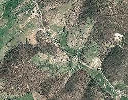 Aerial view of Possum Trot, Virginia | |
 Possum Trot  Possum Trot | |
| Coordinates: 38°28′12″N 79°31′56″W | |
| Country | United States |
| State | Virginia |
| County | Highland |
| Elevation | 2,520 ft (770 m) |
| Time zone | UTC-5 (Eastern (EST)) |
| • Summer (DST) | UTC-4 (EDT) |
| ZIP code | 24465 |
| Area code(s) | 540 |
| GNIS feature ID | 1496110[1] |
References
- "Possum Trot". Geographic Names Information System. United States Geological Survey.
- Google (15 December 2012). "Possum Trot, Virginia" (Map). Google Maps. Google. Retrieved 15 December 2012.
- "The National Map". United States Geological Survey. Retrieved February 7, 2014.
Municipalities and communities of Highland County, Virginia, United States | ||
|---|---|---|
| Town |  Map of Virginia highlighting Highland County | |
| Unincorporated communities | ||
| Footnotes | ‡This populated place also has portions in an adjacent county or counties | |
This article is issued from Wikipedia. The text is licensed under Creative Commons - Attribution - Sharealike. Additional terms may apply for the media files.