Porto de Mós
Porto de Mós (Portuguese pronunciation: [ˈpoɾtu ðɨ ˈmɔʃ] (![]()
Porto de Mós | |
|---|---|
 Castle | |
 Flag  Coat of arms | |
 | |
| Coordinates: 39°36′06″N 8°49′03″W | |
| Country | |
| Region | Centro |
| Intermunic. comm. | Região de Leiria |
| District | Leiria |
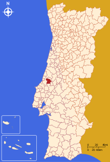
| Parishes | 10 |
| Area | |
| • Total | 261.83 km2 (101.09 sq mi) |
| Population (2011) | |
| • Total | 24,342 |
| • Density | 93/km2 (240/sq mi) |
| Time zone | UTC±00:00 (WET) |
| • Summer (DST) | UTC+01:00 (WEST) |
| Website | www |
There were archeologic findings which link São Jorge, in the parish of Calvaria de Cima, as the exact place where the Battle of Aljubarrota was fought, crucial for maintaining the independence of Portugal in 1385.[3] Currently, there is an interpretation center on the spot (Centre of Interpretation of the Battle of Aljubarrota) which helps visitors explore the battlefield and learn about the most important facts of this battle.[3]
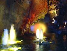
In this municipality, you can also find several caves carved in the mountains, the most important being Moinhos Velhos Cave, also known as Mira de Aire Cave.
A portion of the Serras de Aire e Candeeiros Natural Park is also located in Porto de Mós municipality.
Parishes
Administratively, the municipality is divided into 10 civil parishes (freguesias):[4]
- Alqueidão da Serra
- Alvados e Alcaria
- Arrimal e Mendiga
- Calvaria de Cima
- Juncal
- Mira de Aire
- Pedreiras
- Porto de Mós - São João Baptista e São Pedro
- São Bento
- Serro Ventoso
References
- Instituto Nacional de Estatística
- "Áreas das freguesias, concelhos, distritos e país". Archived from the original on 2018-11-05. Retrieved 2018-11-05.
- "FBA - Fundação Batalha de Aljubarrota". www.fundacao-aljubarrota.pt. Retrieved 2019-10-28.
- Diário da República. "Law nr. 11-A/2013, page 552 100" (pdf) (in Portuguese). Retrieved 29 July 2014.
