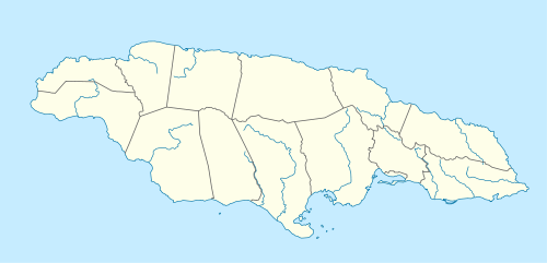
Portmore, Jamaica
Portmore is a large coastal town in southern Jamaica in Saint Catherine, and a dormitory town for the neighbouring city of Kingston and Spanish Town.
Portmore | |
|---|---|
City | |
| Nickname(s): The Sunshine City | |
 Portmore | |
| Coordinates: 17.9499936°N 76.879921°W | |
| Country | |
| County | Middlesex |
| Parish | St Catherine |
| Founded | 1960s |
| Municipalities Act grants municipal status[1] | 2003-05 |
| Government | |
| Population | |
| • Estimate (2011) | 478,946 |
| Time zone | UTC-5 (EST) |
| Area code(s) | +1876 |
| Website | Portmore Municipal Council |
Geography
Portmore, also known as the "Sunshine City", is situated on the south coast in the Parish of St. Catherine. It is approximately 15 miles south-west of the capital of Kingston.[3] It is divided into two regions, the plains to the north and the limestone hills of Hellshire to the south.[4] Portmore has mangrove and saline wetlands to the south east and the alluvium areas in the center and west.[3] The Port Henderson Hill and Hellshire Hill are elevated areas that rise above the gently sloping "Portmore Plains".[3]
The most densely populated areas are located on low-lying reclaimed lands. Portmore consists of communities such as Old Portmore, Greater Portmore, Braeton and Hellshire.[3] Portmore is one of the largest urban areas in St. Catherine with respect to human settlement, having a population 156,468(2001 census) and an annual growth rate of 4% since 1991.[3]
Portmore is built on a generally flat plain facing the Kingston Harbour with an intricate canal system which prevents flooding.[5] Much of the land is reclaimed swamp.[5] Port Henderson Hill, formerly known as Salt Pond Hill, is visible from neighbouring parishes and was a possible Arawak grave site because the Arawak buried their dead in caverns, which Port Henderson Hill is riddled with. The most famous cave is named "Twin Sisters".[5]
History
Portmore began as a large area for schematic residential development in the late 1960s,[5] as the West Indies Home Contractors (WIHCON) organization built thousands of prototype housing units in an effort to alleviate the over-population of Kingston; the first was called Independence City.[5] It has since grown into a suburban city to Kingston; its large population travels into Kingston daily for work, schooling, and many other essential services via the Portmore toll road.
Portmore was granted Municipality status in 2003[1] and has its own city council and mayor, following the British-based model of Jamaican local government.[1] It now houses approximately 10% of the population of the Kingston Corporate Area.
Currently the mayor of Portmore is His Worship the Mayor Leon Thomas.
Portmore has affiliations with music artists Vybz Kartel, Mad Cobra, I-Wayne, Masicka,Gyptian, Spice and many soundsystems such as "Flavor Unit" and "Areacode 876".
Economy
While Portmore is not marketed as a tourist destination for the millions of incoming travelers to Jamaica every year, there are many places for entertainment, eating, relaxing and enjoyment such as beaches, restaurants, hotels and much more.
Transportation
Portmore is served by the Jamaica Urban Transit Company Limited (JUTC) which provides bus transportation for Portmore residents both locally and into Kingston and Spanish Town.
The Portmore Toll Road is the major commuter Highway which connects the city of Kingston and the town, Portmore, via the Hunts Bay Bridge, and Portmore to the old capital of Spanish Town with three lanes in each direction and a speed limit of 110 kilometres per hour (68 mph).
The city is served by the Norman Manley International Airport with over 130 flights weekly.
Sport
Portmore has a professional football team that plays in the Jamaican National Premier League. It was originally Hazard United from May Pen but following its relocation is now called Portmore United F.C..
Horse Racing is popular and all major horse races are run at Caymanas Park located in north Portmore.
Neighbourhoods and districts
- Ascot Scheme
- Bay Front Villas
- Bayside
- Belmont Park
- Bernard Lodge
- Braeton {New Braeton & Old Braeton}
- Bridgeport
- Bridgeview
- Caribbean Estates
- Caymanas Gardens Site A
- Caymanas Gardens Site D
- Cedar Grove Estate
- Christian Gardens
- Christian Meadows
- Cumberland
- Cumberland Meadows
- Daytona
- East Kensington
- East Sabina
- Edgewater
- Epsom
- Garveymeade
- Greater Portmore
- Gregory Park
- Hamilton Gardens
- Hellshire glades
- Independence City
- Marine Park
- Meadowvale
- Monza
- Morris Meadows
- Mount Royal Estate
- Naggo Head
- New Land
- One North
- Palms of Portmore
- Passagefort
- Phoenix Vista
- Portmore Country Club
- Portmore Pines
- Portsmouth
- Portmore Villa
- Sandown Park
- Silverstone
- South Borough
- Surrey Meadows
- Waterford
- West Cumberland
- West Mead
- West Sabina
- West Queens Park
- Westchester
- Westport
- Westbay
References
- Methodology Study, Eris D. Schoburgh, Local Government Reform - National Advisory Council, Department of Local Government.
- http://www.jis.gov.jm/pdf/General%20Report%20Census%202011%20Revised%20Copy%20Oct.%2019.pdf%5B%5D
- "Portmore Project Final Report - Mines and Geology 2" (PDF). portmoremc.gov.jm. Archived from the original (PDF) on 11 September 2018. Retrieved 10 September 2018.
- http://www.nlj.gov.jm/history-notes/History%20of%20Portmore%20Final.pdf
- A short history of Portmore Archived 27 June 2008 at the Wayback Machine, page 2.